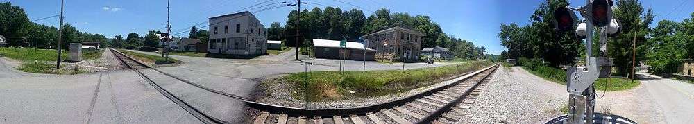
Pax, West Virginia
| Pax, West Virginia | |
|---|---|
| Town | |
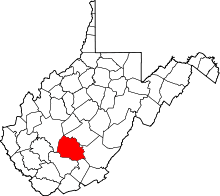
 Location of Pax, West Virginia | |
| Coordinates: 37°54′40″N 81°15′55″W / 37.91111°N 81.26528°WCoordinates: 37°54′40″N 81°15′55″W / 37.91111°N 81.26528°W | |
| Country | United States |
| State | West Virginia |
| County | Fayette |
| Area[1] | |
| • Total | 0.30 sq mi (0.78 km2) |
| • Land | 0.30 sq mi (0.78 km2) |
| • Water | 0 sq mi (0 km2) |
| Elevation | 1,644 ft (501 m) |
| Population (2010)[2] | |
| • Total | 167 |
| • Estimate (2012[3]) | 167 |
| • Density | 556.7/sq mi (214.9/km2) |
| Time zone | Eastern (EST) (UTC-5) |
| • Summer (DST) | EDT (UTC-4) |
| ZIP code | 25904 |
| Area code(s) | 304 |
| FIPS code | 54-62356[4] |
| GNIS feature ID | 1555318[5] |
Pax is a town in Fayette County, West Virginia, United States. The population was 167 at the 2010 census.
The community most likely derives its name from nearby Packs Branch creek.[6]
Geography
According to the United States Census Bureau, the town has a total area of 0.30 square miles (0.78 km2), all of it land.[1]
Demographics
| Historical population | |||
|---|---|---|---|
| Census | Pop. | %± | |
| 1930 | 608 | — | |
| 1940 | 631 | 3.8% | |
| 1950 | 561 | −11.1% | |
| 1960 | 408 | −27.3% | |
| 1970 | 288 | −29.4% | |
| 1980 | 274 | −4.9% | |
| 1990 | 167 | −39.1% | |
| 2000 | 174 | 4.2% | |
| 2010 | 167 | −4.0% | |
| Est. 2015 | 164 | [7] | −1.8% |
2010 census
As of the census[2] of 2010, there were 167 people, 78 households, and 45 families residing in the town. The population density was 556.7 inhabitants per square mile (214.9/km2). There were 102 housing units at an average density of 340.0 per square mile (131.3/km2). The racial makeup of the town was 100.0% White. Hispanic or Latino of any race were 1.2% of the population.
There were 78 households of which 25.6% had children under the age of 18 living with them, 38.5% were married couples living together, 12.8% had a female householder with no husband present, 6.4% had a male householder with no wife present, and 42.3% were non-families. 34.6% of all households were made up of individuals and 17.9% had someone living alone who was 65 years of age or older. The average household size was 2.14 and the average family size was 2.73.
The median age in the town was 41.8 years. 18.6% of residents were under the age of 18; 11.4% were between the ages of 18 and 24; 25.2% were from 25 to 44; 25.2% were from 45 to 64; and 19.8% were 65 years of age or older. The gender makeup of the town was 49.7% male and 50.3% female.
2000 census
As of the census[4] of 2000, there were 199 people, 81 households, and 49 families residing in the town. The population density was 551.5 inhabitants per square mile (209.9/km²). There were 97 housing units at an average density of 307.5 per square mile (117.0/km²). The racial makeup of the town was 97.70% White, 1.15% African American, and 1.15% from two or more races.
There were 78 households out of which 25.6% had children under the age of 18 living with them, 46.2% were married couples living together, 12.8% had a female householder with no husband present, and 35.9% were non-families. 34.6% of all households were made up of individuals and 23.1% had someone living alone who was 65 years of age or older. The average household size was 2.23 and the average family size was 2.86.
In the town the population was spread out with 24.1% under the age of 18, 5.7% from 18 to 24, 24.7% from 25 to 44, 25.3% from 45 to 64, and 20.1% who were 65 years of age or older. The median age was 42 years. For every 100 females there were 93.3 males. For every 100 females age 18 and over, there were 88.6 males.
The median income for a household in the town was $21,875, and the median income for a family was $27,500. Males had a median income of $31,250 versus $18,750 for females. The per capita income for the town was $12,746. About 4.3% of families and 9.7% of the population were below the poverty line, including 5.6% of those under the age of eighteen and 16.7% of those sixty five or over.
Notable people
- Walt Craddock, baseball player.
References
- 1 2 "US Gazetteer files 2010". United States Census Bureau. Archived from the original on January 24, 2012. Retrieved 2013-01-24.
- 1 2 "American FactFinder". United States Census Bureau. Retrieved 2013-01-24.
- ↑ "Population Estimates". United States Census Bureau. Archived from the original on June 17, 2013. Retrieved 2013-06-26.
- 1 2 "American FactFinder". United States Census Bureau. Retrieved 2008-01-31.
- ↑ "US Board on Geographic Names". United States Geological Survey. 2007-10-25. Retrieved 2008-01-31.
- ↑ Kenny, Hamill (1945). West Virginia Place Names: Their Origin and Meaning, Including the Nomenclature of the Streams and Mountains. Piedmont, WV: The Place Name Press. p. 476.
- ↑ "Annual Estimates of the Resident Population for Incorporated Places: April 1, 2010 to July 1, 2015". Retrieved July 2, 2016.
- ↑ "Census of Population and Housing". Census.gov. Archived from the original on May 11, 2015. Retrieved June 4, 2015.