Barrackville, West Virginia
| Barrackville, West Virginia | |
|---|---|
| Town | |
 Location in Marion County and the state of West Virginia. | |
| Coordinates: 39°30′10″N 80°10′11″W / 39.50278°N 80.16972°WCoordinates: 39°30′10″N 80°10′11″W / 39.50278°N 80.16972°W | |
| Country | United States |
| State | West Virginia |
| County | Marion |
| Government | |
| • Mayor | Doug Ice |
| • Town Counsil | Jeff Mullenax, Bob Hollandsworth, David Tonkin, Charles Moore |
| Area[1] | |
| • Total | 0.71 sq mi (1.84 km2) |
| • Land | 0.69 sq mi (1.79 km2) |
| • Water | 0.02 sq mi (0.05 km2) |
| Elevation | 945 ft (288 m) |
| Population (2010)[2] | |
| • Total | 1,302 |
| • Estimate (2012[3]) | 1,307 |
| • Density | 1,887.0/sq mi (728.6/km2) |
| Time zone | Eastern (EST) (UTC-5) |
| • Summer (DST) | EDT (UTC-4) |
| ZIP code | 26559 |
| Area code(s) | 304 |
| FIPS code | 54-04612[4] |
| GNIS feature ID | 1553805[5] |
Barrackville is a town in Marion County, West Virginia, United States. The population was 1,302 at the 2010 census.
Barrackville was settled beginning in 1767 by William "Indian Billy" Ice. The town was named in honor of John Barrack, an early settler. It was incorporated January 25, 1968.
Geography
Barrackville is located at 39°30′10″N 80°10′11″W / 39.50278°N 80.16972°W (39.502741, -80.169713),[6] along Buffalo Creek.[7]
According to the United States Census Bureau, the town has a total area of 0.71 square miles (1.84 km2), of which 0.69 square miles (1.79 km2) is land and 0.02 square miles (0.05 km2) is water.[1]
Demographics
| Historical population | |||
|---|---|---|---|
| Census | Pop. | %± | |
| 1860 | 91 | — | |
| 1870 | 114 | 25.3% | |
| 1880 | 99 | −13.2% | |
| 1970 | 1,545 | — | |
| 1980 | 1,815 | 17.5% | |
| 1990 | 1,443 | −20.5% | |
| 2000 | 1,288 | −10.7% | |
| 2010 | 1,302 | 1.1% | |
| Est. 2015 | 1,321 | [8] | 1.5% |
2010 census
As of the census[2] of 2010, there were 1,302 people, 544 households, and 372 families residing in the town. The population density was 1,887.0 inhabitants per square mile (728.6/km2). There were 602 housing units at an average density of 872.5 per square mile (336.9/km2). The racial makeup of the town was 94.2% White, 4.0% African American, 0.2% Native American, 0.5% Asian, and 1.2% from two or more races. Hispanic or Latino of any race were 1.0% of the population.
There were 544 households of which 29.2% had children under the age of 18 living with them, 52.9% were married couples living together, 11.6% had a female householder with no husband present, 3.9% had a male householder with no wife present, and 31.6% were non-families. 26.5% of all households were made up of individuals and 13.6% had someone living alone who was 65 years of age or older. The average household size was 2.39 and the average family size was 2.91.
The median age in the town was 41.5 years. 21.3% of residents were under the age of 18; 6.7% were between the ages of 18 and 24; 26.7% were from 25 to 44; 27.2% were from 45 to 64; and 18% were 65 years of age or older. The gender makeup of the town was 49.2% male and 50.8% female.
2000 census
As of the census[4] of 2000, there were 1,288 people, 534 households, and 373 families residing in the town. The population density was 1,863.0 inhabitants per square mile (720.7/km²). There were 587 housing units at an average density of 849.0 per square mile (328.5/km²). The racial makeup of the town was 95.03% White, 3.88% African American, 0.16% Native American, 0.08% Asian, 0.08% from other races, and 0.78% from two or more races. Hispanic or Latino of any race were 0.54% of the population.
There were 534 households out of which 28.3% had children under the age of 18 living with them, 55.4% were married couples living together, 11.2% had a female householder with no husband present, and 30.1% were non-families. 26.4% of all households were made up of individuals and 14.6% had someone living alone who was 65 years of age or older. The average household size was 2.41 and the average family size was 2.90.
In the town the population was spread out with 23.0% under the age of 18, 6.8% from 18 to 24, 28.6% from 25 to 44, 24.6% from 45 to 64, and 16.9% who were 65 years of age or older. The median age was 40 years. For every 100 females there were 87.8 males. For every 100 females age 18 and over, there were 82.0 males.
The median income for a household in the town was $31,587, and the median income for a family was $42,969. Males had a median income of $26,354 versus $21,786 for females. The per capita income for the town was $18,506. About 8.2% of families and 8.6% of the population were below the poverty line, including 12.4% of those under age 18 and 5.6% of those age 65 or over.
See also
References
- 1 2 "US Gazetteer files 2010". United States Census Bureau. Archived from the original on 2012-01-24. Retrieved 2013-01-24.
- 1 2 "American FactFinder". United States Census Bureau. Retrieved 2013-01-24.
- ↑ "Population Estimates". United States Census Bureau. Archived from the original on 2013-06-17. Retrieved 2013-06-26.
- 1 2 "American FactFinder". United States Census Bureau. Archived from the original on 2013-09-11. Retrieved 2008-01-31.
- ↑ "US Board on Geographic Names". United States Geological Survey. 2007-10-25. Retrieved 2008-01-31.
- ↑ "US Gazetteer files: 2010, 2000, and 1990". United States Census Bureau. 2011-02-12. Retrieved 2011-04-23.
- ↑ West Virginia Atlas & Gazetteer. Yarmouth, Me.: DeLorme. 1997. p. 25. ISBN 0-89933-246-3.
- ↑ "Annual Estimates of the Resident Population for Incorporated Places: April 1, 2010 to July 1, 2015". Retrieved July 2, 2016.
- ↑ "Census of Population and Housing". Census.gov. Archived from the original on May 11, 2015. Retrieved June 4, 2015.
External links
- http://www.coalcampusa.com/nowv/fairmont/barrackville/barrackville.htm[ Barrackville coal camp.]
Municipalities and communities of Marion County, West Virginia, United States | ||
|---|---|---|
| Cities | 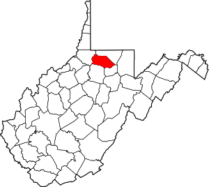 | |
| Towns | ||
| CDPs | ||
| Unincorporated communities |
| |
| Fictional places | ||
| Footnotes | ‡This populated place also has portions in an adjacent county or counties | |