Elkins, West Virginia
| Elkins, West Virginia | |
|---|---|
| City | |
|
Davis Avenue in downtown Elkins in 2006 | |
 Location of Elkins, West Virginia | |
| Coordinates: 38°55′17″N 79°51′3″W / 38.92139°N 79.85083°WCoordinates: 38°55′17″N 79°51′3″W / 38.92139°N 79.85083°W | |
| Country | United States |
| State | West Virginia |
| County | Randolph |
| Government | |
| • Mayor | Van Broughton[1] |
| Area[2] | |
| • Total | 3.43 sq mi (8.88 km2) |
| • Land | 3.43 sq mi (8.88 km2) |
| • Water | 0 sq mi (0 km2) |
| Elevation[3] | 1,926 ft (587 m) |
| Population (2010)[4] | |
| • Total | 7,094 |
| • Estimate (2012[5]) | 7,180 |
| • Density | 2,068.2/sq mi (798.5/km2) |
| Time zone | Eastern (EST) (UTC-5) |
| • Summer (DST) | EDT (UTC-4) |
| ZIP code | 26241 |
| Area code(s) | 304/681 |
| FIPS code | 54-24580 |
| GNIS feature ID | 1551037[6] |
| Website | City Website |

Elkins is a city in Randolph County, West Virginia, USA. The community was incorporated in 1890 and named in honor of Stephen Benton Elkins[7] (1841–1911), a U.S. Senator from West Virginia. The population was 7,094 at the 2010 census. It is the county seat of Randolph County.[8] Elkins is home to Davis and Elkins College and to the Mountain State Forest Festival, held in early October every year.
History
Before its major development, the area that would become Elkins was known as Leadsville, and was the site of a few scattered homesteads — a place where the local farmers’ corn crop was loaded onto boats and floated down the Tygart Valley River. The City of Elkins was developed by U.S. Senators Henry Gassaway Davis (1823–1916) and Stephen Benton Elkins (1841–1911) — and named for the latter — in 1890. (Elkins was Davis’ son-in-law.) The two founders developed railroad lines, coal mines, and timbering businesses. Together, they built the West Virginia Central and Pittsburgh Railway into Elkins in 1889, opening a vast territory to industrial development by the late 1890s. After an intense political "war" with nearby Beverly, where the new county courthouse building was burned down in 1897 under suspicious circumstances, Elkins became the county seat in 1899. This was resolved, however, only after multiple referenda, court judgments, and the mobilization of armed bands in both towns. In the end, bloodshed was averted.
In 1904 the new Randolph County Courthouse — designed in the Richardsonian Romanesque style — was completed in Elkins. As the railroad (merged into the Western Maryland Railway in 1905) expanded, Elkins experienced the luxury of passenger train service. In 1930, 18 passenger trains were arriving and leaving Elkins daily. All passenger service was discontinued in 1958.
Where the view of the new town was most delightful and picturesque, Davis and Elkins each built permanent places of residence, known as Graceland (1893) and Halliehurst (1890), respectively.
Today, Elkins has an active economic development authority, chamber of commerce, downtown business organization and numerous social, fraternal and service organizations that sponsor annual events like the Mountain State Forest Festival, which brings thousands of people into the city every year.
Demographics
| Historical population | |||
|---|---|---|---|
| Census | Pop. | %± | |
| 1890 | 737 | — | |
| 1900 | 2,016 | 173.5% | |
| 1910 | 5,260 | 160.9% | |
| 1920 | 6,788 | 29.0% | |
| 1930 | 7,345 | 8.2% | |
| 1940 | 8,133 | 10.7% | |
| 1950 | 9,121 | 12.1% | |
| 1960 | 8,307 | −8.9% | |
| 1970 | 8,287 | −0.2% | |
| 1980 | 8,536 | 3.0% | |
| 1990 | 7,420 | −13.1% | |
| 2000 | 7,032 | −5.2% | |
| 2010 | 7,094 | 0.9% | |
| Est. 2015 | 7,226 | [9] | 1.9% |
| U.S. Decennial Census[10] 2012 Estimate[11] | |||
2010 census
As of the census[4] of 2010, there were 7,094 people, 3,038 households, and 1,756 families residing in the city. The population density was 2,068.2 inhabitants per square mile (798.5/km2). There were 3,421 housing units at an average density of 997.4 per square mile (385.1/km2). The racial makeup of the city was 96.5% White, 1.2% African American, 0.2% Native American, 0.8% Asian, 0.2% from other races, and 1.2% from two or more races. Hispanic or Latino of any race were 1.1% of the population.
There were 3,038 households of which 26.0% had children under the age of 18 living with them, 40.6% were married couples living together, 12.5% had a female householder with no husband present, 4.8% had a male householder with no wife present, and 42.2% were non-families. 35.4% of all households were made up of individuals and 14.9% had someone living alone who was 65 years of age or older. The average household size was 2.19 and the average family size was 2.80.
The median age in the city was 39.6 years. 20.9% of residents were under the age of 18; 12.2% were between the ages of 18 and 24; 23.2% were from 25 to 44; 26.1% were from 45 to 64; and 17.6% were 65 years of age or older. The gender makeup of the city was 48.0% male and 52.0% female.
2000 census
As of the census[12] of 2000, there were 7,032 people, 2,988 households, and 1,756 families residing in the city. The population density was 2,207.7 people per square mile (851.1/km²). There were 3,362 housing units at an average density of 1,055.5 per square mile (406.9/km²). The racial makeup of the city was 96.94% White, 0.90% African American, 0.30% Native American, 0.95% Asian, 0.31% from other races, and 0.60% from two or more races. Hispanic or Latino of any race were 0.77% of the population.
There were 2,988 households out of which 25.0% had children under the age of 18 living with them, 43.4% were married couples living together, 11.9% had a female householder with no husband present, and 41.2% were non-families. 35.8% of all households were made up of individuals and 15.0% had someone living alone who was 65 years of age or older. The average household size was 2.19 and the average family size was 2.83.
In the city the population was spread out with 21.2% under the age of 18, 11.7% from 18 to 24, 25.4% from 25 to 44, 24.0% from 45 to 64, and 17.7% who were 65 years of age or older. The median age was 39 years. For every 100 females there were 92.4 males. For every 100 females age 18 and over, there were 86.9 males.
The median income for a household in the city was $26,906, and the median income for a family was $34,291. Males had a median income of $27,012 versus $19,154 for females. The per capita income for the city was $17,916. About 14.4% of families and 19.0% of the population were below the poverty line, including 25.4% of those under age 18 and 9.6% of those age 65 or over.
Geography
Elkins is located at the confluence of the Tygart Valley River and Leading Creek.[13] The average elevation is 2,000 feet (610 m) above sea level. According to the United States Census Bureau, the city has a total area of 3.43 square miles (8.88 km2), all land.[2] Elkins is headquarters for the Monongahela National Forest, a 910,155-acre (368,327 ha) federal reserve encompassing the "High Alleghenies" area to the east of the city.
In 1995, a second edition of The 100 Best Small Towns in America, written by Norman Crampton, featured Elkins among the special places in the United States. Crampton quoted then Editor Emerita of The Inter-Mountain, Eldora Marie Bolyard Nuzum, "You can stand on any street in Elkins and turn in all directions and see forest covered mountains rimming the city. It is unbelievable." [14]
Climate
| Climate data for Elkins, West Virginia (1981–2010 normals) | |||||||||||||
|---|---|---|---|---|---|---|---|---|---|---|---|---|---|
| Month | Jan | Feb | Mar | Apr | May | Jun | Jul | Aug | Sep | Oct | Nov | Dec | Year |
| Record high °F (°C) | 78 (26) |
77 (25) |
86 (30) |
90 (32) |
93 (34) |
96 (36) |
99 (37) |
99 (37) |
97 (36) |
87 (31) |
82 (28) |
76 (24) |
99 (37) |
| Average high °F (°C) | 39.0 (3.9) |
42.8 (6) |
51.7 (10.9) |
62.8 (17.1) |
70.7 (21.5) |
77.9 (25.5) |
81.0 (27.2) |
80.2 (26.8) |
73.7 (23.2) |
64.0 (17.8) |
53.3 (11.8) |
42.3 (5.7) |
61.6 (16.4) |
| Average low °F (°C) | 19.4 (−7) |
21.5 (−5.8) |
28.0 (−2.2) |
36.6 (2.6) |
45.5 (7.5) |
54.6 (12.6) |
59.0 (15) |
58.0 (14.4) |
50.7 (10.4) |
38.4 (3.6) |
30.5 (−0.8) |
22.7 (−5.2) |
38.7 (3.7) |
| Record low °F (°C) | −24 (−31) |
−22 (−30) |
−15 (−26) |
3 (−16) |
20 (−7) |
25 (−4) |
32 (0) |
34 (1) |
26 (−3) |
11 (−12) |
−8 (−22) |
−28 (−33) |
−28 (−33) |
| Average precipitation inches (mm) | 3.22 (81.8) |
3.09 (78.5) |
3.95 (100.3) |
3.79 (96.3) |
5.12 (130) |
4.39 (111.5) |
5.36 (136.1) |
3.84 (97.5) |
3.63 (92.2) |
2.85 (72.4) |
3.38 (85.9) |
3.26 (82.8) |
45.88 (1,165.3) |
| Average snowfall inches (cm) | 25.2 (64) |
18.5 (47) |
12.1 (30.7) |
5.5 (14) |
0 (0) |
0 (0) |
0 (0) |
0 (0) |
0 (0) |
0.4 (1) |
5.2 (13.2) |
16.8 (42.7) |
83.8 (212.9) |
| Average precipitation days (≥ 0.01 in) | 17.9 | 15.5 | 16.4 | 15.2 | 15.4 | 14.8 | 14.4 | 12.8 | 11.1 | 11.5 | 13.2 | 16.7 | 174.8 |
| Average snowy days (≥ 0.1 in) | 12.7 | 10.5 | 6.9 | 3.3 | 0 | 0 | 0 | 0 | 0 | .5 | 3.8 | 10.0 | 47.7 |
| Source: NOAA (extremes 1899–present)[15] | |||||||||||||
Record weather events include:
- High temperature: 99 °F (37 °C) on July 16, 1988 and on August 6, 1918
- Highest daily min: 78 °F (26 °C) on July 21, 1930
- Lowest daily max: −6 °F (−21 °C) on December 25, 1983
- Low temperature: −28 °F (−33 °C) on December 30, 1917
- Highest one-day snowfall: 19.9 inches (51 cm), on December 19, 2009.
- Highest one-day precipitation: 5.02 inches (12.8 cm), on November 4, 1985.
Events
- Augusta Heritage Festival – a music and heritage festival, with 10+ themes ranging from Old Time, Blue Grass, Cajun, Irish, dance, wood and metal working and more. Attracting musicians and students from around the world, it is held on the Davis and Elkins College campus and in town over 5 consecutive weeks every summer, typically in July and August. There is also a week-long Old Time event in October, and a dulcimer week in the spring.[16]
- Mountain State Forest Festival – an annual, early fall festival and fair held on the streets of Elkins and on the Davis and Elkins College Campus. Lasts several days in early fall; the 70th annual event was held in 2006.[17]
- Pickin' in the Park – a Wednesday afternoon Old Time fiddling get-together in the park. It is held year round, moving inside during the winter.
- Randolph County International Ramp Cookoff and Festival – an annual festival at city park and on the Davis & Elkins College campus at the end of April. The focus of this celebration is the ramp, an indigenous herb which is prevalent in the Elkins region. Featuring a cooking competition of ramp inclusive recipes, other activities include concerts, craft vendors and more.[18]
Transportation
- Highways
Elkins sits at the junction of US 33, US 219, and US 250. Heading west of the city, US 33 is Corridor H, a major four-lane highway connecting to Interstate 79 at Weston. Long-term plans call for Corridor H to be extended further past Elkins eventually to Interstate 81 at Strasburg, Virginia.
- Airport
Elkins–Randolph County Airport (Jennings Randolph Airfield) ( code KEKN) is a regional airport with two large runways, each over 4,000 feet (1,200 m) long with plans for lengthening the runways by at least 500 feet (150 m). The community leaders are planning to expand the facilities at the airport in order to serve the growing need for a regional air service and the increase in federal usage and general aviation activity.
Notable natives and residents
- James E. Allen, Jr. – educator
- Herman Ball – Football player.
- William Wallace "Wally" Barron – former West Virginia governor, who was later indicted for bribery and jury tampering.
- Henry Gassaway Davis – U.S. senator from West Virginia in 1871–1883 and 1904 Democratic candidate for Vice-President
- Stephen Benton Elkins – U.S. senator from West Virginia in 1895–1911, Secretary of War and namesake of the town
- Marshall Goldberg – NFL football player
- Clarence "Fuzzy" Haskins – Parliament-Funkadelic bass player
- Eldora Marie Bolyard Nuzum – first female editor of a daily newspaper in West Virginia and interviewer of U.S. Presidents
- John Ochsendorf – MIT Professor and MacArthur Fellow
- Jae Spears – West Virginia state legislator
- Tre Smith – Canadian Football League running back
References
- ↑ Broughton, Van (2013-03-05). "New Mayor, One New City Council Member Elected in Elkins". Retrieved 2015-07-29.
- 1 2 "US Gazetteer files 2010". United States Census Bureau. Retrieved 2013-01-24.
- ↑ "Elkins, West Virginia". Geographic Names Information System. United States Geological Survey.
- 1 2 "American FactFinder". United States Census Bureau. Retrieved 2013-01-24.
- ↑ "Population Estimates". United States Census Bureau. Retrieved 2013-06-26.
- ↑ "US Board on Geographic Names". United States Geological Survey. 2007-10-25. Retrieved 2008-01-31.
- ↑ Gannett, Henry (1905). The Origin of Certain Place Names in the United States. Govt. Print. Off. p. 117.
- ↑ "Find a County". National Association of Counties. Retrieved 2011-06-07.
- ↑ "Annual Estimates of the Resident Population for Incorporated Places: April 1, 2010 to July 1, 2015". Retrieved July 2, 2016.
- ↑ United States Census Bureau. "Census of Population and Housing". Retrieved August 27, 2013.
- ↑ "Annual Estimates of the Resident Population: April 1, 2010 to July 1, 2012". Retrieved August 27, 2013.
- ↑ "American FactFinder". United States Census Bureau. Retrieved 2008-01-31.
- ↑ West Virginia Atlas & Gazetteer. Yarmouth, Me.: DeLorme. 1997. p. 37. ISBN 0-89933-246-3.
- ↑ Crampton, Norman, The 100 Best Towns in America, 2nd Edition, McMillan, Inc., New York, New York, 134-37.
- ↑ "NowData – NOAA Online Weather Data". National Oceanic and Atmospheric Administration. Retrieved 2013-06-30.
- ↑ Augusta Heritage Center
- ↑ Mountain State Forest Festival
- ↑ Randolph County Festival
External links
| Wikimedia Commons has media related to Elkins, West Virginia. |
-
 Elkins travel guide from Wikivoyage
 - City of Elkins, official website
- The InterMountain – daily newspaper
- Picture of the Randolph County Courthouse, in Elkins
- Elkins info, photos, and history from the Traveling 219 project
Municipalities and communities of Randolph County, West Virginia, United States | ||
|---|---|---|
| City | 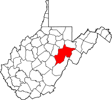 | |
| Towns | ||
| CDPs | ||
| Unincorporated communities |
| |
| Ghost towns | ||
| Footnotes | ‡This populated place also has portions in an adjacent county or counties | |