Bridgeport, West Virginia
| Bridgeport, West Virginia | |
|---|---|
| City | |
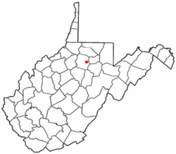 Location of Bridgeport, West Virginia | |
| Coordinates: 39°17′48″N 80°15′5″W / 39.29667°N 80.25139°WCoordinates: 39°17′48″N 80°15′5″W / 39.29667°N 80.25139°W | |
| Country | United States |
| State | West Virginia |
| County | Harrison |
| Government | |
| • Type | Manager Plan |
| • City Manager | A. Kim Haws |
| • Mayor | Robert L. Greer |
| Area[1] | |
| • Total | 10.56 sq mi (27.35 km2) |
| • Land | 10.52 sq mi (27.25 km2) |
| • Water | 0.04 sq mi (0.10 km2) |
| Elevation | 1,020 ft (311 m) |
| Population (2010)[2] | |
| • Total | 8,149 |
| • Estimate (2012[3]) | 8,355 |
| • Density | 774.6/sq mi (299.1/km2) |
| Time zone | Eastern (EST) (UTC-5) |
| • Summer (DST) | EDT (UTC-4) |
| ZIP code | 26330 |
| Area code(s) | 304, 681 |
| FIPS code | 54-10180[4] |
| GNIS feature ID | 1536341[5] |
| Website | www.bridgeportwv.com |
Bridgeport is a city in Harrison County, West Virginia, USA. The population was 8,149 at the 2010 census.
The town of Bridgeport had its beginning in pre-American Revolutionary War times. In 1764, John Simpson entered the area and gave his name to Simpson Creek. Bridgeport was chartered in 1816. When the town was incorporated in 1887, it established the office of mayor and town council. The city currently employs a City Manager. Bridgeport is home to Meadowbrook Mall, a 100-store regional shopping complex serving North-Central West Virginia.
History
Bridgeport originally got its name from a cartographer’s mistake. Settled in the mid-1700s by early fur traders who came west over the Allegheny Mountains, settlers were forced to build forts to protect themselves from the elements, as well as from Native Americans who didn’t care for the intrusion on their lands. Thus, as legend has it, what was known as Bridge Fort was mistakenly deemed Bridgeport.
On June 29, 2006, the city became noted as the site of a showdown over the issue of separation of church and state in the United States. A portrait of Jesus originally hung on a wall at Bridgeport High School. Two parents filed suit in federal court to have the portrait removed, after the Harrison County Board of Education deadlocked over whether to remove the portrait. The portrait of Jesus was stolen from Bridgeport High School early in the morning on August 17, 2006 and a mirror was put in its place.
In 2016, a baseball team from Bridgeport won the Little League state championship.
Bridgeport landmarks
- Pete Dye Golf Club opened in 1993, rated the number one golf course in WV and number 99 on America's 100 Greatest Golf Courses by Golf Digest.[6]
- Simpson Creek Baptist Church is recognized as the oldest Baptist church in West Virginia by the West Virginia Baptist Convention and is also generally accepted as being the oldest Protestant church west of the Allegheny Mountains. The first formal records of the church are dated 1774.
- Simpson Creek Covered Bridge located off of Meadowbrook Rd. Built in 1881 by Asa Hugill. One of only two covered bridges that still stand today in Harrison County.
- The Bridgeport Lamp Chimney Company Bowstring Concrete Arch Bridge
- The Governor Joseph Johnson House, aka Oakdale.
Notable people
- Michael Late Benedum founder of Benedum-Trees Oil Company
- Mike Florio, sports writer
- Governor Joseph Johnson of Virginia
- Senator Waldo Porter Johnson of Missouri
- T. Michael Martin, Young Adult novelist, author of ''The End Games''
- Colonel Benjamin Wilson
Education
High schools
Primary and middle schools
- Bridgeport Middle School
- Johnson Elementary School
- Simpson Elementary School
- Heritage Christian School
Libraries
Geography
Bridgeport is located at 39°17′48″N 80°15′5″W / 39.29667°N 80.25139°W (39.296544, -80.251305),[7] along Simpson Creek.[8]
According to the United States Census Bureau, the city has a total area of 10.56 square miles (27.35 km2), of which, 10.52 square miles (27.25 km2) is land and 0.04 square miles (0.10 km2) is water.[1]
Demographics
| Historical population | |||
|---|---|---|---|
| Census | Pop. | %± | |
| 1880 | 395 | — | |
| 1890 | 455 | 15.2% | |
| 1900 | 464 | 2.0% | |
| 1910 | 577 | 24.4% | |
| 1920 | 1,346 | 133.3% | |
| 1930 | 1,567 | 16.4% | |
| 1940 | 1,581 | 0.9% | |
| 1950 | 2,414 | 52.7% | |
| 1960 | 4,199 | 73.9% | |
| 1970 | 4,777 | 13.8% | |
| 1980 | 6,604 | 38.2% | |
| 1990 | 6,739 | 2.0% | |
| 2000 | 7,306 | 8.4% | |
| 2010 | 8,149 | 11.5% | |
| Est. 2015 | 8,359 | [9] | 2.6% |
2010 census
As of the census[2] of 2010, there were 8,149 people, 3,458 households, and 2,383 families residing in the city. The population density was 774.6 inhabitants per square mile (299.1/km2). There were 3,678 housing units at an average density of 349.6 per square mile (135.0/km2). The racial makeup of the city was 95.5% White, 1.1% African American, 0.2% Native American, 1.9% Asian, 0.2% from other races, and 1.1% from two or more races. Hispanic or Latino of any race were 1.7% of the population.
There were 3,458 households of which 30.2% had children under the age of 18 living with them, 56.7% were married couples living together, 9.2% had a female householder with no husband present, 3.1% had a male householder with no wife present, and 31.1% were non-families. 28.2% of all households were made up of individuals and 12.8% had someone living alone who was 65 years of age or older. The average household size was 2.34 and the average family size was 2.86.
The median age in the city was 44.7 years. 21.9% of residents were under the age of 18; 5.1% were between the ages of 18 and 24; 23.5% were from 25 to 44; 30.8% were from 45 to 64; and 18.8% were 65 years of age or older. The gender makeup of the city was 47.7% male and 52.3% female.
2000 census
As of the census[4] of 2000, there were 7,306 people, 2,988 households, and 2,103 families residing in the city. The population density was 880.4 people per square mile (339.9/km²). There were 3,190 housing units at an average density of 384.4 per square mile (148.4/km²). The racial makeup of the city was 96.93% White, 1.25% African American, 0.05% Native American, 1.05% Asian, 0.19% from other races, and 0.52% from two or more races. Hispanic or Latino of any race were 1.29% of the population.
There were 2,988 households out of which 30.5% had children under the age of 18 living with them, 60.8% were married couples living together, 7.9% had a female householder with no husband present, and 29.6% were non-families. 26.9% of all households were made up of individuals and 13.5% had someone living alone who was 65 years of age or older. The average household size was 2.41 and the average family size was 2.94.
In the city the population was spread out with 23.0% under the age of 18, 5.7% from 18 to 24, 25.0% from 25 to 44, 26.7% from 45 to 64, and 19.6% who were 65 years of age or older. The median age was 43 years. For every 100 females there were 87.2 males. For every 100 females age 18 and over, there were 83.1 males.
The median income for a household in the city was $49,310, and the median income for a family was $58,825. Males had a median income of $46,590 versus $29,861 for females. The per capita income for the city was $25,132. About 3.7% of families and 5.0% of the population were below the poverty line, including 6.6% of those under age 18 and 3.6% of those age 65 or over.
References
- 1 2 "US Gazetteer files 2010". United States Census Bureau. Archived from the original on 2012-01-24. Retrieved 2013-01-24.
- 1 2 "American FactFinder". United States Census Bureau. Retrieved 2013-01-24.
- ↑ "Population Estimates". United States Census Bureau. Archived from the original on 2013-06-17. Retrieved 2013-06-26.
- 1 2 "American FactFinder". United States Census Bureau. Archived from the original on 2013-09-11. Retrieved 2008-01-31.
- ↑ "US Board on Geographic Names". United States Geological Survey. 2007-10-25. Retrieved 2008-01-31.
- ↑ http://www.petedye.com/sites/courses/greatoaks.asp?id=758&page=44096
- ↑ "US Gazetteer files: 2010, 2000, and 1990". United States Census Bureau. 2011-02-12. Retrieved 2011-04-23.
- ↑ DeLorme (1997). West Virginia Atlas & Gazetteer. Yarmouth, Maine: DeLorme. p.25. ISBN 0-89933-246-3.
- ↑ "Annual Estimates of the Resident Population for Incorporated Places: April 1, 2010 to July 1, 2015". Retrieved July 2, 2016.
- ↑ "Census of Population and Housing". Census.gov. Archived from the original on May 11, 2015. Retrieved June 4, 2015.
External links
| Wikivoyage has a travel guide for Bridgeport (West Virginia). |
Municipalities and communities of Harrison County, West Virginia, United States | ||
|---|---|---|
| Cities | 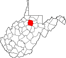 | |
| Towns | ||
| CDPs | ||
| Unincorporated communities |
| |