Padworth
| Padworth | |
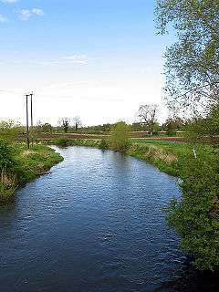 The Kennet from Padworth Bridge. |
|
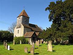 Padworth church is next to Padworth College, once the manor of the parish. |
|
 Padworth |
|
| Area | 5.71 km2 (2.20 sq mi) |
|---|---|
| Population | 919 (2011 census)[1] |
| – density | 161/km2 (420/sq mi) |
| OS grid reference | SU619661 |
| Civil parish | Padworth |
| Unitary authority | West Berkshire |
| Ceremonial county | Berkshire |
| Region | South East |
| Country | England |
| Sovereign state | United Kingdom |
| Post town | READING |
| Postcode district | RG7 |
| Dialling code | 0118 |
| Police | Thames Valley |
| Fire | Royal Berkshire |
| Ambulance | South Central |
| EU Parliament | South East England |
| UK Parliament | Berkshire |
Coordinates: 51°23′35″N 1°06′50″W / 51.393°N 1.114°W
Padworth is a lightly populated locality and civil parish in the English county of Berkshire, the nearest town to which is Tadley. Padworth is in the unitary authority of West Berkshire and its main settlement is at Aldermaston Wharf or Lower Padworth where it has Aldermaston railway station. It has its southern boundary with Mortimer West End, Hampshire. The south of the parish is wooded towards its edges and the north of the parish is agricultural with a hotel beside the Kennet and Avon Canal. In the centre of the parish is a school, Padworth College, which is a Georgian and later incarnation of its manor house.
Geography and amenities
Padworth proper is around the little Norman church and the old manor house, from 1748 home of the Darby-Griffith family but in the 20th century converted into Padworth College, an independent co-educational boarding and day school for students aged 13–19.
The two-halves of the parish can be separated and named:
- Lower Padworth or Aldermaston Wharf, most concentrated along the A4 Bath Road – this area has the vast majority of homes. It is where built-up a nucleated village and low rise locality.
- Padworth Common sometimes describes all of the scattered south but strictly speaking only includes land outside of the farmland of the former manor centred on the site of Padworth College.
Lower Padworth has Aldermaston railway station. Padworth has its southern boundary with Mortimer West End, Hampshire. The south of the parish is wooded towards its edges and the north of the parish is agricultural with a hotel beside the Kennet and Avon Canal.
Demography
| Output area | Homes owned outright | Owned with a loan | Socially rented | Privately rented | Other | Usual residents | km² |
|---|---|---|---|---|---|---|---|
| Civil parish | 88 | 130 | 68 | 40 | 8 | 919 | 5.71 |
Land use statistics are not available for this civil parish. These figures under the census heading 'Physical Environment' can be obtained for the broader ward of 'Mortimer' from the data pages of the last census from the 2005 Office for National Statistics survey.[1]
Economy
Economic history
A 'fishery in the Kenette' was among the possessions of the manor in 1586, and a fishery is mentioned as early as 1378. There is a Scheduled Ancient Monument fish-pond north of the independent school (former manor). In 1870 its real property was valued at £1,839 (equivalent to £158,689 in 2015 in general expenditure) while its population was much smaller than today, 298, living in 59 houses.[2]
Current economy
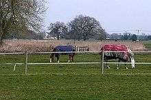
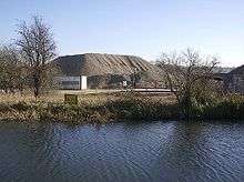
The whole parish is noted by the 1920s to be very well watered, and the north-eastern part draws on the natural advantage of a fairly flat landscape and water close to the surface from the Kennet. The soil remains a strength its inorganic layers being "gravel and the subsoil [impermeable] clay".[3] The local economy in the 1920s centred on the chief crops: wheat, barley, oats and roots.[3] These remain regular crops in Padworth alongside hay meadows for livestock, horses and donkeys. Gravel extraction, education, agriculture, transport and tourism provide jobs in Padworth itself. Aldermaston railway station next at Aldermaston Wharf serves two of these sectors. Commuting to towns, industrial, logistic and trading business centres is the most common source of employment as at the 2011 census, with for instance Reading and Newbury about 20–30 minutes away whether by rail or by access to the M4 motorway.[1] Tadley also provides a major source of retail, leisure and general high street service employment, the nearest town.
History
Grim's Ditch which runs from the mid-south of the area 0.5 miles (0.80 km) (into the southern forest of Ufton Nervet) is posited to be a 'sub-Roman' bank and ditch dug to defend Calleva Atrebatum (Silchester Roman Town) when the Anglo-Saxons began to settle the area.
The place is recorded in such documents as the Assize Rolls and national Feet of Fines (on property sale) as Peadanwurthe (10th century); Peteorde (11th century); Pedewurth (12th century); Padewrd, Padworze (13th century); Padesworth, Pappeworth (14th century).[3]
Manors
A full descent of the manor including its earliest known grant of 956, and during the Black Death is provided by the fully referenced text of the Victoria County History for this parish, compiled here in 1923.[3]
A secondary manor of Padworth (Hussey's) existed under John de la Husse in the 13th century, after whom it was named. It farmed at the Domesday Survey 2½ hides, which was held of William de Ow by a man named 'Gozelin' and in this instance its Saxon era owner was recorded as 'Ælfstan' with its nominal dues (that is, being held under) the crown (King Edward the Confessor). The period of titled bearers owning either manor was when the main manor (sometimes called Coudrays) was held by Sir Benjamin Tichborne, bart. and the Forster baronets (1629–1681). The manor house is Grade II* listed (the mid-category).[4] It was built afresh in 1769 by designs of John Hobcraft. It has plasterwork by Joseph Rose. Its entrance is a double-height space, a staircase with a wrought iron balustrade to three sides. It has a vaulted 3-bay arched arcadess on each floor to one side with Doric columns on the ground floor and columns with Adamesque capitals on the floor above.[4]
Other land
Place names that were here in the 17th century are: Ball's Pidle, Yew Pidle, Pondes Close, Little and Great Burfeildes, Culmers Wood and Bartholomew's, Brickworth Coppice.[3]
The inclosure of the common land at Padworth was by its Private Act of Parliament of 1811 under the established limited compensatory procedures of the time.[3]
Church
Architecture
The Church of England parish church of St John the Baptist is aisleless and built about 1130 with two three-light Tudor period ornately carved windows and with its vestry and porch having been added in 1890. A smaller tudor window is pictured above, with two lights on the south-east square tower façade, above the font, which does not have the entrance. The roof of the nave was largely replaced in the 19th century.[3] Rare features include the Norman chancel arch and north and south doorways, the semi-domed apse and the 18th-century monuments.[5] It is listed in the top category of listed building, Grade I.[6]
History
The church's advowson was from Priory of Monk Sherborne (Pamber Priory) by the year 1291 when various of its tithes and donations provided the Prior's pension.[3] Upon the Dissolution of the Monasteries the advowson was exercised by the Crown until the 19th century. A parish rentcharge totalling £250 in 1848 was received by the rector, the parishioners having commutated the tithes; the parish glebe stood at 28 acres (0.11 km2).[7] By 1923 the rector's patron was the Lord Chancellor.[3]
Anglican community
The ecclesiastical parish is united as part of the benefice of Stratfield Mortimer, Mortimer West End and Padworth which has four churches and two church schools. The church alternates its Sunday service between 9 am Eucharist and 6.30 Evensong.[8]
See also
References
- 1 2 3 4 Key Statistics: Dwellings; Quick Statistics: Population Density; Physical Environment: Land Use Survey 2005 Accessed 10 December 2014.
- ↑ Imperial Gazetteer of Great Britain (1870–72, London) John Marius Wilson from visionofbritain.org.uk – University of Portsmouth and others. Accessed 10 December 2014
- 1 2 3 4 5 6 7 8 9 'Parishes: Padworth', in A History of the County of Berkshire: Volume 3 ed. P H Ditchfield and William Page (London, 1923), pp. 413–417. Accessed 10 December 2014.
- 1 2 Historic England. "Details from listed building database (1117314)". National Heritage List for England. Padworth College (former manor house). Citing:
BOE, Berkshire, p. 191; Berkshire Architectural Guide, Betjeman, John and Piper, John;
Country Life, Vol. 52, pp. 342–348, 372–378, 414–417 - ↑ Betjeman, John, ed. (1968) Collins Pocket Guide to English Parish Churches; the South. London: Collins; p. 114
- ↑ Historic England. "Details from listed building database (1155386)". National Heritage List for England.
- ↑ 'Padfield' A Topographical Dictionary of England, ed. Samuel Lewis (publisher) (London, 1848), pp. 525–530. Accessed 10 December 2014.
- ↑ Stratfield Mortimer and Mortimer West End Benefice: Parish of Padworth (St John the Baptist) The Church of England Accessed 10 December 2014.]
External links
![]() Media related to Padworth at Wikimedia Commons
Media related to Padworth at Wikimedia Commons