Swingle, California
Coordinates: 38°33′30″N 121°40′32″W / 38.55833°N 121.67556°W
| Swingle | |
|---|---|
| Unincorporated community | |
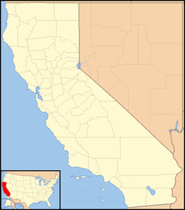 Swingle  Swingle Location in California | |
| Coordinates: 38°33′30″N 121°40′32″W / 38.55833°N 121.67556°W | |
| Country | United States |
| State | California |
| County | Yolo County |
| Elevation[1] | 33 ft (10 m) |
Swingle is an unincorporated community in Yolo County, California. It is located on the Union Pacific Railroad 4 miles (6.4 km) east of Davis[2] at an elevation of 33 feet (10 m). In the late 19th century, Swingle contained cattle pens and was a shipment point on the Southern Pacific Railroad for cattle to market.[3] A 1913 book described Swingle, along with Webster, as along the main automobile route from Davis to Broderick.[4]
References
- ↑ U.S. Geological Survey Geographic Names Information System: Swingle, California
- ↑ Durham, David L. (1998). California's Geographic Names: A Gazetteer of Historic and Modern Names of the State. Clovis, Calif.: Word Dancer Press. p. 565. ISBN 1-884995-14-4.
- ↑ Crofutt, George A. (1878). Crofutt's New Overland Tourist and Pacific Coast Guide. The Overland Publishing Company. p. 200.
- ↑ Drury, Wells; Aubrey Drury (1913). California tourist guide and handbook: authentic description of routes of travel and points of interest in California. Western guidebook company. p. 189. Retrieved 2009-06-16.
Municipalities and communities of Yolo County, California, United States | ||
|---|---|---|
| Cities |  | |
| CDPs | ||
| Unincorporated communities |
| |
| Ghost towns | ||
| Footnotes | ‡This populated place also has portions in an adjacent county or counties | |
This article is issued from Wikipedia - version of the 11/5/2016. The text is available under the Creative Commons Attribution/Share Alike but additional terms may apply for the media files.