Nova Prata
| Nova Prata, Rio Grande do Sul | |
|---|---|
| Nickname(s): Capital Nacional do Basalto | |
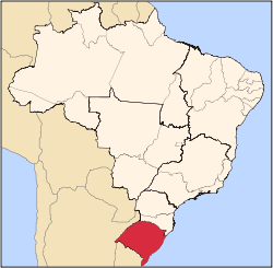
 Geographical subdivisions of Rio Grande do Sul. Nova Prata is marked red. | |
| Coordinates: 28°47′S 51°36′W / 28.783°S 51.600°WCoordinates: 28°47′S 51°36′W / 28.783°S 51.600°W | |
| Country | Brazil |
| State | Rio Grande do Sul |
| Meso-region | Nordeste Rio-Grandense |
| Micro-region | Guapore |
| Government | |
| • Mayor | Vitor Antonio Pletsch |
| Area | |
| • Total | 259.1 km2 (100.0 sq mi) |
| Elevation | 820 m (2,690 ft) |
| Population (2012) | |
| • Total | 23,600 |
| Website |
www |
Nova Prata is a municipality in the mountainous Serra Gaúcha region of Rio Grande do Sul, in southern Brazil. It is in the Guapore micro-region of the Nordeste Rio-Grandense meso-region of the state.
Geography
The city of Nova Prata is situated at about 28°47′0″S 51°36′40″W / 28.78333°S 51.61111°W, at an altitude of 700 meters. The municipality occupies an area of 258.743 km²[1] or 259.1 km².[2] In 2012 the population was estimated to be 23,600. Temperature ranges from a minimum of 4 °C to a maximum of 39 °C with an annual average of 17 °C.
Nova Prata is surrounded by the municipalities of: André da Rocha and Guabiju to the north; Fagundes Varela and Vila Flores to the south; Nova Bassano, Nova Araçá and Vista Alegre do Prata to the west; and Protásio Alves to the east.
Twin towns
 Cittadella, Italy
 Noblesville, USA
References
- ↑ Rio Grande do Sul » Nova Prata (in Portuguese). Instituto Brasileiro de Geografia e Estatística. Accessed November 2013.
- ↑ Localização (in Portuguese). Município de Nova Prata. Accessed November 2013.