Sneads, Florida
| Sneads, Florida | |
|---|---|
| Town | |
 Location in Jackson County and the state of Florida | |
| Coordinates: 30°42′35″N 84°55′33″W / 30.70972°N 84.92583°WCoordinates: 30°42′35″N 84°55′33″W / 30.70972°N 84.92583°W | |
| Country |
|
| State |
|
| County | Jackson |
| Government | |
| • Type | City Council Government |
| • City Manager | Connie Butts |
| Area | |
| • Total | 4.6 sq mi (12 km2) |
| • Land | 4.4 sq mi (11.5 km2) |
| • Water | 0.2 sq mi (0.5 km2) |
| Elevation | 118 ft (36 m) |
| Population (2015) | |
| • Total | 1,812 |
| • Density | 417.2/sq mi (159.9/km2) |
| Time zone | Central (CST) (UTC-6) |
| • Summer (DST) | CDT (UTC-5) |
| ZIP code | 32460 |
| Area code(s) | 850 |
| FIPS code | 12-66725[1] |
| GNIS feature ID | 0291299[2] |
Sneads is a town in Jackson County, Florida, United States. The population was 1,849 at the 2010 census.Sneads is governed by a five-member Town Council and a City Manager. It also has an all Volunteer Fire Rescue Department, and its own Police Force of six sworn officers and five dispatchers.The current Chief of Police is Burt McAlpin, the City Manager is Connie Butts, the Fire Chief is Buddy Jeter. Sneads is home to Sneads High School. Although not in the city limits, The Florida Department of Corrections operates Appalachee Correctional Institution which is the largest employer in the Sneads area. Sneads was founded in 1894. In 2016 Sneads Police was awarded a grant for new Police equipment.
Geography
Sneads is located at 30°42′35″N 84°55′33″W / 30.70972°N 84.92583°W (30.709836, -84.925869).[3]
According to the United States Census Bureau, the town has a total area of 4.6 square miles (12 km2), of which 4.4 square miles (11 km2) is land and 0.2 square miles (0.52 km2) (4.54%) is water.
Demographics
| Historical population | |||
|---|---|---|---|
| Census | Pop. | %± | |
| 1900 | 368 | — | |
| 1910 | 506 | 37.5% | |
| 1920 | 492 | −2.8% | |
| 1930 | 637 | 29.5% | |
| 1940 | 727 | 14.1% | |
| 1950 | 1,074 | 47.7% | |
| 1960 | 1,399 | 30.3% | |
| 1970 | 1,550 | 10.8% | |
| 1980 | 1,690 | 9.0% | |
| 1990 | 1,746 | 3.3% | |
| 2000 | 1,919 | 9.9% | |
| 2010 | 1,849 | −3.6% | |
| Est. 2015 | 1,776 | [4] | −3.9% |
As of the census[1] of 2000, there were 1,919 people, 796 households, and 554 families residing in the town. The population density was 434.0 inhabitants per square mile (167.6/km²). There were 887 housing units at an average density of 200.6 per square mile (77.5/km²). The racial makeup of the town was 79.05% White, 16.78% African American, 0.89% Native American, 0.10% Asian, 1.93% from other races, and 1.25% from two or more races. Hispanic or Latino of any race were 3.34% of the population.
There were 796 households out of which 31.7% had children under the age of 18 living with them, 50.6% were married couples living together, 13.6% had a female householder with no husband present, and 30.4% were non-families. 27.3% of all households were made up of individuals and 12.6% had someone living alone who was 65 years of age or older. The average household size was 2.41 and the average family size was 2.90.
In the town the population was spread out with 25.5% under the age of 18, 9.0% from 18 to 24, 26.5% from 25 to 44, 24.5% from 45 to 64, and 14.5% who were 65 years of age or older. The median age was 37 years. For every 100 females there were 95.8 males. For every 100 females age 18 and over, there were 90.9 males.
The median income for a household in the town was $30,690, and the median income for a family was $37,162. Males had a median income of $25,917 versus $23,674 for females. The per capita income for the town was $15,113. About 11.2% of families and 17.2% of the population were below the poverty line, including 27.1% of those under age 18 and 11.0% of those age 65 or over.
References
- 1 2 "American FactFinder". United States Census Bureau. Retrieved 2008-01-31.
- ↑ "US Board on Geographic Names". United States Geological Survey. 2007-10-25. Retrieved 2008-01-31.
- ↑ "US Gazetteer files: 2010, 2000, and 1990". United States Census Bureau. 2011-02-12. Retrieved 2011-04-23.
- ↑ "Annual Estimates of the Resident Population for Incorporated Places: April 1, 2010 to July 1, 2015". Retrieved July 2, 2016.
- ↑ "Census of Population and Housing". Census.gov. Retrieved June 4, 2015.
Municipalities and communities of Jackson County, Florida, United States | ||
|---|---|---|
| Cities | 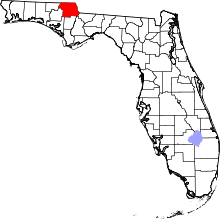 | |
| Towns | ||
| Unincorporated communities | ||