Rogues Point, South Australia
| Rogues Point South Australia | |||||||||||||
|---|---|---|---|---|---|---|---|---|---|---|---|---|---|
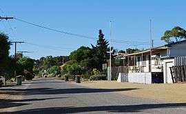 A street in Rogues Point | |||||||||||||
 Rogues Point | |||||||||||||
| Coordinates | 34°29′48″S 137°53′41″E / 34.49669°S 137.8947°ECoordinates: 34°29′48″S 137°53′41″E / 34.49669°S 137.8947°E | ||||||||||||
| Population | 63 (shared with James Well) (2011 census)[1] | ||||||||||||
| Established | 1999[2] | ||||||||||||
| Postcode(s) | 5571[3] | ||||||||||||
| Time zone | ACST (UTC+9:30) | ||||||||||||
| • Summer (DST) | ACST (UTC+10:30) | ||||||||||||
| Location |
| ||||||||||||
| LGA(s) | Yorke Peninsula Council[2] | ||||||||||||
| State electorate(s) | Goyder[4] | ||||||||||||
| Federal Division(s) | Grey[5] | ||||||||||||
| |||||||||||||
| |||||||||||||
| Footnotes |
Distances[3] Coordinates[2] Climate[6] Adjoining localities[2] | ||||||||||||
Rogues Point is a locality in the Australian state of South Australia located on the east coast of Yorke Peninsula immediately adjoining Gulf St Vincent about 80 kilometres (50 mi) north-west of the Adelaide city centre and about 6.9 kilometres (4.3 mi) of the centre of Ardrossan.[3][2][7]
Its boundaries were created in May 1999 in respect to the “long established name.”[2][8]
As of 2014, the land use within the locality is divided into the following two zones that are parallel to the coastline - a strip of land zoned as “coastal open space” which is reserved both for community use and as a buffer against sea level rise, and a strip of land zoned as “settlement” which consists of an area of low density residential and associated buildings.[7]
Rogues Point is located within the federal division of Grey, the state electoral district of Goyder and the local government area of the Yorke Peninsula Council.[2][4][5]
See also
References
- ↑ Australian Bureau of Statistics (31 October 2012). "James Well". 2011 Census QuickStats. Retrieved 25 February 2016.
- 1 2 3 4 5 6 7 "Search result for "Rogues Point (Locality Bounded)" (Record no SA0059386)". Property Location Browser. Department of Planning, Transport and Infrastructure. Retrieved 25 February 2016.
- 1 2 3 "Rogues Point, South Australia (Postcode)". postcodes-australia.com. Retrieved 25 February 2016.
- 1 2 "Goyder electorate boundaries as of 2014". ELECTORAL COMMISSION SA. Retrieved 23 July 2015.
- 1 2 "Federal electoral division of Grey" (PDF). Australian Electoral Commission. Retrieved 24 July 2015.
- ↑ "Monthly climate statistics: Summary statistics PRICE". Commonwealth of Australia , Bureau of Meteorology. Retrieved 25 February 2016.
- 1 2 "Development Plan - Yorke Peninsula Council" (PDF). Department of Planning, Transport and Infrastructure. pp. 120, 133, 327–329 & 447–449. Retrieved 25 February 2016.
- ↑ Kentish, P. M. (27 May 1999), "GEOGRAPHICAL NAMES ACT 1991, Notice to Assign Boundaries and Names to Places", The South Australian Government Gazette: 2696, retrieved 5 December 2015