Rocha Estância
| Rocha Estância | |
|---|---|
 Monte Estância | |
| Highest point | |
| Elevation | 357 m (1,171 ft) |
| Prominence | 357 m (1,171 ft) |
| Listing | List of mountains in Cape Verde |
| Coordinates | 16°N 22°W / 16°N 22°WCoordinates: 16°N 22°W / 16°N 22°W |
| Geography | |
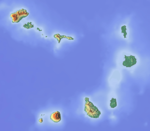 Rocha Estância southeastern Boa Vista | |
| Geology | |
| Mountain type | Stratovolcano (extinct) |
| Last eruption | unknown |
| Climbing | |
| First ascent | unknown |
| Easiest route | road and hiking |
Rocha Estância is a mountain in the southwestern part of the island Boa Vista in Cape Verde, next to the village of Povoação Velha.[1] The etymology of the name of the mountain is related to cattle ranching that was done over the years.
Its elevation is 357 meters and is the second tallest on the island. The area forms a protected area known as Rocha Estância Natural Monument (Monumento Natural de Rocha Estância) which protects flor aand fauna, its total area is 253 ha and its perimeter is 6,817 meters.[1]
The area are bounded to three streams: Baixa (lower), Doutor (teacher) and Fonte (spring) which separates other mountainous formations, it has conditions for agricultural practices. Near the area of the settlement in the western part has activity is outside the protected area.
The Our Lady of Conception church is located in the western part. On the mountaintop, views of the islands of São Nicolau and Maio can be seen[2]
See also
References
| Wikimedia Commons has media related to Rocha Estância. |
- 1 2 Proposta de Plano de Gestão de Zonas Húmidas - Boavista/ Cabo Verde (in Portuguese). Ministério do Ambiente e Agricultura. pp. 59–63.
- ↑ "Boa Vista Island at capeverde.com".
Further reading
- REITMEIER, Pitt and FORTES, Lucete. Goldstadt Hiking Map Boa Vista Sal Maio 1 : 50,000. Goldstadt-Verlag 2004. ISBN 3-89550-470-X
- Ricardo A. S. Ramalho, Building the Cape Verde Islands, Springer, 2011, p. 101
External links
The island of Boa Vista and the surrounding islands | ||
|---|---|---|
| Communities and settlements | 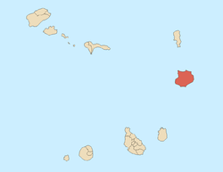 | |
| Parishes | ||
| Mountains | ||
| Beaches | ||
| Other geographical features |
| |
| Features surrounding the island |
| |