Ponta da Fragata
| Ponta da Fragata | |
|---|---|
 | |
| Location | Eastern Sal, Cape Verde |
| Coordinates | 16°38′42″N 22°53′8″W / 16.64500°N 22.88556°WCoordinates: 16°38′42″N 22°53′8″W / 16.64500°N 22.88556°W |
| Offshore water bodies | Atlantic Ocean |
Ponta da Fragata (Portuguese meaning "tip of the frigate") is a headland on the east coast of the island of Sal, Cape Verde. It is situated at the foot of the Serra Negra mountain, 6 km northeast of the town Santa Maria. The headland is named after a frigate that was sunk somewhere in the 1960s as chocolate were being shipped from the Congo region to Denmark in northcentral Europe, the frigate was seen throughout most of the southern half of the island that it sunk tens of metres below sea level, the abandoned frigate collapsed into the ocean and is no longer seen.. The Costa da Fragata which is a nature reserve and a marine park that includes the location of the sunken frigate are a protected area[1]
See also
References
- ↑ "Protected areas of Cape Verde" (in Portuguese).
External links
The island of Sal, Cape Verde | ||
|---|---|---|
| Settlements | 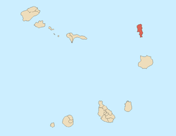 | |
| Parishes | ||
| Points and promontories | ||
| Lighthouses |
| |
| Other geographical features | ||
This article is issued from Wikipedia - version of the 12/4/2016. The text is available under the Creative Commons Attribution/Share Alike but additional terms may apply for the media files.