Hansapur, Rapti
| Hansapur हंसपुर | |
|---|---|
| Village Development Committee | |
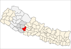
 Hansapur Location in Nepal | |
| Coordinates: 27°56′N 82°54′E / 27.93°N 82.90°ECoordinates: 27°56′N 82°54′E / 27.93°N 82.90°E | |
| Country |
|
| Region | Mid-Western |
| Zone | Rapti Zone |
| District | Pyuthan District |
| VDC | Hansapur |
| Population (2001 Census[1]) | |
| • Total | 3,008 |
| 495 households | |
| Time zone | Nepal Time (UTC+5:45) |
Hansapur is a Village Development Committee in Pyuthan, a Middle Hills district of Rapti Zone, western Nepal. The village lies to the north east of the district sharing its border mainly to Aargakhanchi. The area is mostly inhabited by Bhramins and other castes too. The village or VDC is prominently a developing area in the district with proper facilities of electricity and communication. The place is well established for ginger (Aduwa) and bee honey (Maha; local).
Etymology
hamsa (Nepali: हंस) - soul, spirit, heart
pur (Nepali: पुर)- town or city.
Thus: town of souls
Villages in VDC
| Village| | Ward | Lat. | Lon | Elev. | |
|---|---|---|---|---|---|
| Baguwa | बगुवा | 1 | 27°55'N | 82°55'E | 430m |
| Baike | बैके | 9 | 27°58'N | 82°50'E | 510 |
| Bange | बाङगे | 6 | 27°58'N | 82°52'E | 670 |
| Bangge | बाङगे | 6 | 27°58'N | 82°53'E | 430 |
| Beore | बेवरे | 7 | 27°58'N | 82°51'E | 610 |
| Chabha | चाभा | 6 | 27°57'N | 82°52'E | 890 |
| Dhab | ढाब | 7 | 27°57'N | 82°51'E | 910 |
| Dumai | दुमै | 1 | 27°56'N | 82°56'E | 550 |
| Dhuwakot | दुवाकोट | 8 | 27°57'N | 82°51'E | 990 |
| Ghorlate | घोर्लटे | 5 | 27°57'N | 82°54'E | 690 |
| Gotheri | गोठेरी | 4 | 27°56'N | 82°54'E | 810 |
| Gurungdanda | गुरुङडाँडा | 8 | 27°57'N | 82°51'E | 1,043 |
| Hansapur | हंसपुर | 1 | 27°56'N | 82°54'E | 810 |
| Jabune | जाबुने | 1 | 27°55'N | 82°55'E | 410 |
| Kaskot | कासकोट | 6 | 27°57'N | 82°53'E | 930 |
| Khewarepani | केवरेपानी | 9 | 27°58'N | 82°50'E | 870 |
| Machhedi | मछेडी | 1 | 27°57'N | 82°55'E | 410 |
| Odale | ओदाले | 5 | 27°58'N | 82°53'E | 490 |
| Okhardanda | ओखरडाँडा | 9 | 27°57'N | 82°51'E | 870 |
| Panaha | पनाहा | 7 | 27°58'N | 82°52'E | 430 |
| Sajekot | सजेकोट | 4 | 27°57'N | 82°53'E | 950 |
| Sujanpur | सुजनपुर | 5 | 27°57'N | 82°53'E | 690 |
| Udin dhungga | उदिन ढुङगा | 8 | 27°57'N | 82°52'E | 950 |
Edited By Bikram Rana Hanspur - Pyuthan
References
- ↑ "Nepal Census 2001". Nepal's Village Development Committees. Digital Himalaya. Retrieved 21 September 2008.
- ↑ "Index of Geographical Names of Nepal, Volume IV: Mid Western Development Region, List of Settlements, Pyuthan" (PDF). Government of Nepal, National Geographic Information Infrastructure Program. Retrieved 2011-03-12.
External links
This article is issued from Wikipedia - version of the 4/15/2015. The text is available under the Creative Commons Attribution/Share Alike but additional terms may apply for the media files.