Markabang
| Markabang मर्काबाङ | |
|---|---|
| Village Development Committee | |
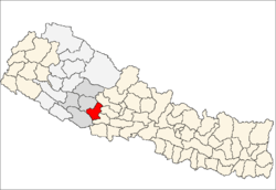
 Markabang Location in Nepal | |
| Coordinates: 28°01′N 82°43′E / 28.02°N 82.72°ECoordinates: 28°01′N 82°43′E / 28.02°N 82.72°E | |
| Country |
|
| Region | Mid-Western |
| Zone | Rapti Zone |
| District | Pyuthan District |
| VDC | Markabang |
| Population (2001 Census[1]) | |
| • Total | 2,649 |
| 456 households | |
| Time zone | Nepal Time (UTC+5:45) |
Markabang is a village and Village Development Committee in Pyuthan, a Middle Hills district of Rapti Zone, western Nepal.
Villages in this VDC
| Ward | Lat. | Lon | Elev. | ||
|---|---|---|---|---|---|
| Batule | बाटुले | 28°03'N | 82°44'E | 650m | |
| Dhan | ढाण | 28°00'N | 82°44'E | 1,210 | |
| Dhan Chaur | धान चौर | 3 | 28°01'N | 82°44'E | 810 |
| Dhand | ढाँड | 28°01'N | 82°45'E | 1,410 | |
| Dhikaban | ढिकाबन | 9 | 28°02'N | 82°44'E | 670 |
| Golbang | गोलबाङ | 28°00'N | 82°45'E | 998 | |
| Khukuli Chaur | खुकुली चौर | 7 | 28°01'N | 82°42'E | 1,085 |
| Markabang | मर्काबाङ | 5 | 28°01'N | 82°43'E | 1,330 |
| Pipal Chheda | पिपल छेडा | 28°01'N | 82°42'E | 1,390 | |
| Pukruk | पुक्रुक | 28°02'N | 82°43'E | 1,330 | |
| Ratapani | रातापानी | 4 | 28°01'N | 82°44'E | 971 |
| Ritha Chaur | रिठा चौर | 28°01'N | 82°43'E | 1,350 | |
| Thuli Chaur | ठूली चौर | 28°00'N | 82°45'E | 1,470 |
References
- ↑ "Nepal Census 2001". Nepal's Village Development Committees. Digital Himalaya. Retrieved 21 September 2008.
- ↑ "Index of Geographical Names of Nepal, Volume IV: Mid Western Development Region, List of Settlements, Pyuthan" (PDF). Government of Nepal, National Geographic Information Infrastructure Program. Retrieved 2011-03-12.
External links
This article is issued from Wikipedia - version of the 2/21/2015. The text is available under the Creative Commons Attribution/Share Alike but additional terms may apply for the media files.