Columbia Township, Dubois County, Indiana
| Columbia Township | |
|---|---|
| Township | |
|
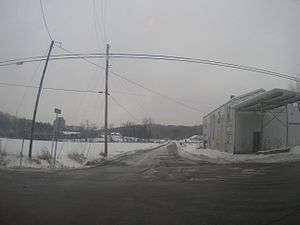
Looking south on Cuzco Road from Highway 56, in Columbia Township | |
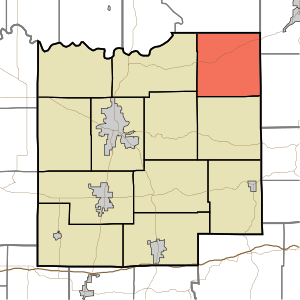 Location of Columbia Township in Dubois County | |
| Coordinates: 38°28′53″N 86°44′01″W / 38.48139°N 86.73361°WCoordinates: 38°28′53″N 86°44′01″W / 38.48139°N 86.73361°W | |
| Country | United States |
| State | Indiana |
| County | Dubois |
| Government | |
| • Type | Indiana township |
| Area | |
| • Total | 36.43 sq mi (94.4 km2) |
| • Land | 36.18 sq mi (93.7 km2) |
| • Water | 0.25 sq mi (0.6 km2) |
| Elevation[1] | 564 ft (172 m) |
| Population (2010) | |
| • Total | 1,065 |
| • Density | 29.4/sq mi (11.4/km2) |
| FIPS code | 18-14608[2] |
| GNIS feature ID | 453238 |
Columbia Township is one of twelve townships in Dubois County, Indiana. As of the 2010 census, its population was 1,065 and it contained 467 housing units.[3]
Geography
According to the 2010 census, the township has a total area of 36.43 square miles (94.4 km2), of which 36.18 square miles (93.7 km2) (or 99.31%) is land and 0.25 square miles (0.65 km2) (or 0.69%) is water.[3]
Unincorporated towns
(This list is based on USGS data and may include former settlements.)
Adjacent townships
- Lost River Township, Martin County (north)
- French Lick Township, Orange County (northeast)
- Jackson Township, Orange County (east)
- Hall Township (south)
- Marion Township (southwest)
- Harbison Township (west)
Major highways
Cemeteries
The township contains three cemeteries: Burton, Robinson and Wininger.
References
- "Columbia Township, Dubois County, Indiana". Geographic Names Information System. United States Geological Survey. Retrieved 2009-09-24.
- United States Census Bureau cartographic boundary files
- ↑ "US Board on Geographic Names". United States Geological Survey. 2007-10-25. Retrieved 2008-01-31.
- ↑ "American FactFinder". United States Census Bureau. Archived from the original on 2013-09-11. Retrieved 2008-01-31.
- 1 2 "Population, Housing Units, Area, and Density: 2010 - County -- County Subdivision and Place -- 2010 Census Summary File 1". United States Census. Retrieved 2013-05-10.
External links
Municipalities and communities of Dubois County, Indiana, United States | ||
|---|---|---|
| Cities | ||
| Towns | ||
| Townships | ||
| CDP | ||
| Other unincorporated communities | ||
| Ghost town | ||
| Footnotes | ‡This populated place also has portions in an adjacent county or counties | |
This article is issued from Wikipedia - version of the 11/28/2016. The text is available under the Creative Commons Attribution/Share Alike but additional terms may apply for the media files.