West Fork, Indiana
| West Fork | |
|---|---|
| Unincorporated community | |
 West Fork | |
| Coordinates: 38°14′01″N 86°31′35″W / 38.23361°N 86.52639°WCoordinates: 38°14′01″N 86°31′35″W / 38.23361°N 86.52639°W | |
| Country | United States |
| State | Indiana |
| County | Crawford |
| Township | Union |
| Elevation[1] | 515 ft (157 m) |
| ZIP code | 47118 |
| FIPS code | 18-82718[2] |
| GNIS feature ID | 451618 |
West Fork is an unincorporated community in Union Township, Crawford County, Indiana.
History
West Fork was named from fork in the river nearby.[3] The first post office at West Fork opened in 1871.[4]
Geography
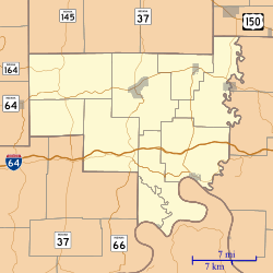
West Fork is located at 38°14′01″N 86°31′35″W / 38.23361°N 86.52639°W.
References
- ↑ "US Board on Geographic Names". United States Geological Survey. 2007-10-25. Retrieved 2008-01-31.
- ↑ "American FactFinder". United States Census Bureau. Retrieved 2008-01-31.
- ↑ Baker, Ronald L. (October 1995). From Needmore to Prosperity: Hoosier Place Names in Folklore and History. Indiana University Press. p. 343. ISBN 978-0-253-32866-3.
...was named for the West Fork of the Little Blue River...
- ↑ "Crawford County". Jim Forte Postal History. Retrieved 30 August 2014.
Municipalities and communities of Crawford County, Indiana, United States | ||
|---|---|---|
| Towns | ||
| Townships | ||
| Unincorporated communities | ||
| Footnotes | ‡This populated place also has portions in an adjacent county or counties | |
This article is issued from Wikipedia - version of the 10/26/2016. The text is available under the Creative Commons Attribution/Share Alike but additional terms may apply for the media files.