Weißenkirchen an der Perschling
| Weißenkirchen an der Perschling | ||
|---|---|---|
| ||
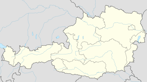 Weißenkirchen an der Perschling Location within Austria | ||
| Coordinates: 48°16′00″N 15°46′00″E / 48.26667°N 15.76667°ECoordinates: 48°16′00″N 15°46′00″E / 48.26667°N 15.76667°E | ||
| Country | Austria | |
| State | Lower Austria | |
| District | Sankt Pölten-Land | |
| Government | ||
| • Mayor | Reinhard Breitner (ÖVP) | |
| Area | ||
| • Total | 23.8 km2 (9.2 sq mi) | |
| Elevation | 220 m (720 ft) | |
| Population (1 January 2016)[1] | ||
| • Total | 1,328 | |
| • Density | 56/km2 (140/sq mi) | |
| Time zone | CET (UTC+1) | |
| • Summer (DST) | CEST (UTC+2) | |
| Postal code | 3142 | |
| Area code | 02784 | |
| Vehicle registration | PL | |
| Website | www.weissenkirchen-perschling.noe.gv.at | |

Weißenkirchen an der Perschling is a municipality in the district of Sankt Pölten-Land in the Austrian state of Lower Austria.
Population
| Historical population | ||
|---|---|---|
| Year | Pop. | ±% |
| 1951 | 1,243 | — |
| 1961 | 1,172 | −5.7% |
| 1971 | 1,228 | +4.8% |
| 1981 | 1,170 | −4.7% |
| 1991 | 1,296 | +10.8% |
| 2001 | 1,331 | +2.7% |
| 2012 | 1,315 | −1.2% |
References
- ↑ Statistik Austria - Bevölkerung zu Jahresbeginn 2002-2016 nach Gemeinden (Gebietsstand 1.1.2016) for Weißenkirchen an der Perschling.
This article is issued from Wikipedia - version of the 12/2/2013. The text is available under the Creative Commons Attribution/Share Alike but additional terms may apply for the media files.