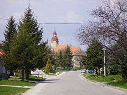
Suchá nad Parnou
| Suchá nad Parnou | |
| Village | |
 | |
| Country | Slovakia |
|---|---|
| Region | Trnava |
| District | Trnava |
| Coordinates | SK 48°24′35″N 17°29′23″E / 48.40972°N 17.48972°ECoordinates: SK 48°24′35″N 17°29′23″E / 48.40972°N 17.48972°E |
| Area | 14.38 km2 (5.55 sq mi) |
| Population | 1,738 (2004-12-31) |
| Density | 121/km2 (313/sq mi) |
| Postal code | 919 01 |
| Car plate | TT |
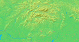  Location of Suchá nad Parnou in Slovakia | |
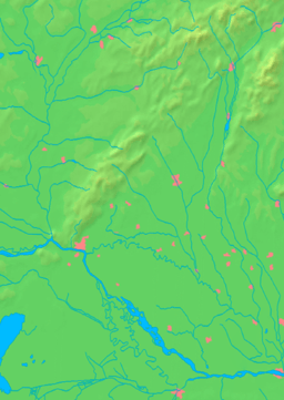  Location of Suchá nad Parnou in the Trnava Region | |
| Statistics: MOŠ/MIS | |
Suchá nad Parnou is a village and municipality in the Trnava District in the Trnava region of Slovakia. The municipality is located in the Trnava Upland, partially in the valley of the rivers Podháj and Parná. Suchá nad Parnou has an area of 1468 ha and is situated at an altitude of 161-231 m above sea level, with the center of the village at 174 m above sea level. The village Šelpice lays to the East, to the Southeast and South lay Zvončín and Ružindol, in the east Suchá nad Parnou is bordered by Dlhá. To the North Košolná, Boleráz and on Northwest Klčovany are located. Suchá nad Parnou is situated about 7 km to the west of Trnava.
External links
- http://en.e-obce.sk/obec/suchanadparnou/sucha-nad-parnou.html
- http://www.suchanadparnou.sk/ (Slovak)
This article is issued from Wikipedia - version of the 3/7/2016. The text is available under the Creative Commons Attribution/Share Alike but additional terms may apply for the media files.