Southlake, Texas
| Southlake, Texas | |
|---|---|
| City | |
| City of Southlake, Texas | |
|
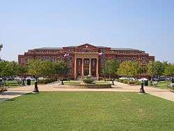
Southlake City Hall, Southlake Town Square | |
 Location of Southlake in Tarrant County, Texas | |
| Coordinates: 32°56′48″N 97°8′43″W / 32.94667°N 97.14528°WCoordinates: 32°56′48″N 97°8′43″W / 32.94667°N 97.14528°W | |
| Country |
|
| State |
|
| Counties | Tarrant, Denton |
| Incorporated | 1956 |
| Government | |
| • Type | Council-Manager |
| • City Council | Mayor Laura Hill[1] |
| • Town Council |
Council members
|
| • House of Representatives |
Representatives
|
| • TX Senate |
Senators
|
| • U.S. Congress |
Congress members
|
| Area | |
| • Total | 22.5 sq mi (58.1 km2) |
| • Land | 21.9 sq mi (56.7 km2) |
| • Water | 0.6 sq mi (1.4 km2) 2.45% |
| Elevation | 640 ft (195 m) |
| Population (2010)[3] | |
| • Total | 26,575 |
| • Density | 983.0/sq mi (379.6/km2) |
| Time zone | CST (UTC-6) |
| • Summer (DST) | CDT (UTC-5) |
| ZIP code | 76092 |
| Area code(s) | 817, 214, 972 |
| FIPS code | 48-69032[4] |
| GNIS feature ID | 1347589[5] |
| Website | www.cityofsouthlake.com |
Southlake is a city located predominately in Tarrant County with minor areas extending into Denton County[6] in the U.S. state of Texas that is suburb of the Dallas/Fort Worth Metropolitan area. As of the 2010 census it had a population of 26,575.[7] Southlake is known for public schools, Southlake Town Square, its wealth, Gateway Church and Carroll High School's 8-time state champion Football and Men's Swim & Dive team.[8]
History
The Southlake area was settled by pioneers in the 1840s, but was not incorporated as Southlake until 1956, four years after Grapevine Lake was finished.[9] Before incorporation, the settlements of Whites Chapel, Dove, Union Church and Jellico made up present day Southlake. The area remained rural until the completion of the DFW International Airport in the 1970s. Due to the close proximity to the airport, Southlake became a boom-burb throughout the 1980s, 1990s and 2000s. As of 2012, Southlake's population is almost at full capacity, with around 27,000 residents. The expected build-out population is projected around 34,000 residents.
Overview
In March 2016, Southlake was ranked no. 5 on a list called 'The $100K Club: America’s Highest-Earning Cities'. High earners in Southlake are the majority of residents: 71.2% of households make over $100,000 a year. [10]
In May 2014, in an article in the Times magazine, Southlake was rated among the top 10 wealthiest zip codes in the country. The Southlake Zipcode: 76092 was ranked at No. 9 with 58.7% of households making more than $150,000. [11]
In 2009, Southlake's zip code, 76092, was ranked as the richest zip code in the United States with a population between 10,000–25,000 people. The average home in Southlake costs around $784,522 and has 4 bedrooms, 4 bathrooms and around 4,000 square feet (370 m2).
In December 2008, Forbes.com named Southlake the most affluent neighborhood in the United States based on average median household income estimates.[12] The mean household income for the city of Southlake is $216,393.[13]
Economy
Sabre Holdings, an S&P 500 company, is headquartered in Southlake in the Solana business park. Industrial businesses include gasoline storage and distribution and concrete works on the east side of town off Highway 114 near DFW Airport.
Southlake is well known for its Southlake Town Square project, a shopping center located on State Highway 114 and Southlake Boulevard. A plan was approved in March 2005 that allowed the Town Square's area to be doubled. The new additions to Town Square were completed in the summer of 2006, making it one of the most popular shopping centers in the Metroplex.
Top employers
According to Southlake’s 2014 Comprehensive Annual Financial Report,[14] the top employers in the city are:
| # | Employer | # of Employees |
|---|---|---|
| 1 | Sabre Holdings | 3,000 |
| 2 | Carroll ISD | 1123 |
| 3 | Verizon Wireless | 367 |
| 4 | Gateway Church | 570 |
| 5 | Keller Williams | 487 |
| 6 | Central Market | 360 |
| 7 | City of Southlake | 337 |
| 8 | Apple | 203 |
Geography
Southlake is located at 32°56′48″N 97°8′43″W / 32.94667°N 97.14528°W (32.946678, −97.145230).[15] According to the United States Census Bureau, the city has a total area of 22.5 square miles (58 km2), of which, 21.9 square miles (57 km2) of it is land and 0.6 square miles (1.6 km2) of it (2.45%) is water.
Surrounding municipalities
 |
Westlake (8 miles) |
Trophy Club (8 miles) |
Grapevine | |
| Keller (6 miles) |
|
Grapevine (4 miles) | ||
| ||||
| | ||||
| North Richland Hills | North Richland Hills (6 miles) |
Colleyville |
Demographics
| Historical population | |||
|---|---|---|---|
| Census | Pop. | %± | |
| 1960 | 1,023 | — | |
| 1970 | 2,031 | 98.5% | |
| 1980 | 2,808 | 38.3% | |
| 1990 | 7,065 | 151.6% | |
| 2000 | 21,519 | 204.6% | |
| 2010 | 26,575 | 23.5% | |
| Est. 2015 | 29,941 | [16] | 12.7% |
As of the census[4] of 2000, there were 21,519 people, 6,414 households, and 5,958 families residing in the city. The population density was 983.0 people per square mile (379.6/km²). There were 6,614 housing units at an average density of 302.1 per square mile (116.7/km²). The ethnic makeup of the city was 94.54% White, 1.39% African American, 0.25% Native American, 1.79% Asian, 0.01% Pacific Islander, 0.81% from other ethnic groups, and 1.20% from two or more ethnic groups. Hispanic or Latino of any ethnic group were 3.67% of the population.
There were 6,414 households out of which 60.5% had children under the age of 18 living with them, 88.0% were married couples living together, 3.5% had a female householder with no husband present, and 7.1% were non-families. 5.4% of all households were made up of individuals and 1.2% had someone living alone who was 65 years of age or older. The average household size was 3.35 and the average family size was 3.48. The average listing price for homes for sale in Southlake TX was $883,109 for the week ending Jan 08.[18] 3,997 of the 6,602 occupied houses have nine or more rooms. 4,660 of the occupied houses have four or more bedrooms. 3,342 of the 6,602 occupied houses have two cars. 2,348 of these houses have three or more cars. 3,790 of these houses cost more than $300,000.
In the city the population was spread out with 37.1% under the age of 18, 3.9% from 18 to 24, 30.2% from 25 to 44, 25.7% from 45 to 64, and 3.1% who were 65 years of age or older. The median age was 37 years. For every 100 females there were 100.6 males. For every 100 females age 18 and over, there were 98.0 males.
According to a 2011 estimate, the median income for a household in the city was in excess of $194,000, higher than any other city in the DFW Metroplex, and the median income for a family was $176,259. The mean household income for the city of Southlake is $216,393.[13] Males had a median income of $100,000 versus $46,042 for females. The per capita income for the city was $47,597. As of 2010, 43% of homes had an income of more than $200,000.[19] About 1.3% of families and 1.8% of the population were below the poverty line, including 2.0% of those under age 18 and 2.1% of those age 65 or over.
Median Income for Southlake by Age
Source:[20]
| Age | Median Income |
|---|---|
| 25-34 | $162,283 |
| 35-44 | $176,297 |
| 45-54 | $190,261 |
| 55-64 | $190,726 |
| 65-74 | $182,447 |
| 75+ | $178,043 |
Local government
Incorporated in 1956, the City of Southlake’s home rule charter was approved by voters on April 4, 1987, operating under a Council-Manager form of government. Services provided by the City under general governmental functions include public events, public safety, planning and development, engineering, street maintenance, parks operation and maintenance, recreation, library services, and general administrative services. According to the city’s 2013-2014 Comprehensive Annual Financial Report, the city’s various funds had $104.2 million in revenues, $79.6 million in expenditures, $678.6 million in total assets, $182.1 million in total liabilities, and $108.8 million in cash and investments. [21]
The structure of the management and coordination of city services is: [22]
| City Department | Director |
|---|---|
| City Manager | Shana K. Yelverton |
| Assistant City Manager | Alison D. Ortowski |
| Assistant City Manager | Benjamin E. Thatcher |
| Chief Financial Officer | Sharen Jackson |
| Police Chief | James Brandon |
| Fire Chief | Michael Starr |
| Economic Development Director | Shannon Hamon |
| Human Resources Director | Stacey S. Black |
| Planning and Development Services Director | Ken Baker |
| Public Works Director | Robert Price |
| City Secretary | Lori Payne |
Neighborhoods
In the early 1990s when Southlake began developing master-planned neighborhoods, the minimum lot size was 1-acre (4,000 m2). Later the City of Southlake reduced the minimum lot size to 1/2 acre, and later 1/3 of an acre. These master-planned upscale neighborhoods began popping up all over the western portion of Southlake Boulevard. Some of the larger upscale neighborhoods developed in the 90's along Southlake Boulevard include The Hills of Monticello, Monticello Estates, Stoneridge Lakes, Myers Meadow, Stone Lakes, Timber Lake, Southridge Lakes and Timarron, which includes the Timarron Country Club. In the 2000s when the earlier neighborhoods were finishing out, Southlake began developing portions of its picturesque countryside into luxury neighborhoods. Some of the newer luxury neighborhoods include Clariden Ranch, Estes Park, Stratford Park, Cambridge Place, Shady Oaks, Westwick Hills, The Enclave, Laurelwood Park, Villas Del Sol, Palomar Estates, The Reserve of Southlake, Coventry Manor, Autumn Creek Estates and Versailles.


Highways
Notable people
- Giovanni Capriglione, Republican member of the Texas House of Representatives from District 98 since 2013
- Frank Edgard Cornish IV, NFL-Dallas Cowboys
- Riley Dodge, Former Quarterback at McNeese State University. Now assists in coaching Quarterbacks at the University of Texas at Austin.
- Terry Bradshaw, former NFL quarterback
- Eric Nauwelaers, CEO Frontier meats
- DeMarcus Ware, NFL-Dallas Cowboys
- Sam Schwartzstein, football player
- Marcus Spears, NFL defensive end-Dallas Cowboys
- Pat Summerall, sports announcer, former NFL placekicker-Detroit Lions, Chicago Cardinals, New York Giants
- Tony Tolbert, former NFL defensive end-Dallas Cowboys
- Y.E. Yang, PGA Championship winner (2009)
- Mark McLemore, former MLB second baseman/outfielder
- Jon Daniels, Texas Rangers General Manager
- Julius Jones, NFL running back-Dallas Cowboys, Seattle Seahawks, current New Orleans Saints running back
- Greg Ellis, former NFL defensive end-Dallas Cowboys, Oakland Raiders
- Terrence Newman, NFL cornerback-Dallas Cowboys, Cincinnati Bengals, Kansas State University graduate
- Chase Daniel, NFL quarterback-New Orleans Saints
- Garrett Hartley, NFL kicker-New Orleans Saints
- Russell Maryland, former NFL defensive tackle-Dallas Cowboys, Oakland Raiders, Green Bay Packers
- Bruce DeHaven, current special teams NFL coach for Buffalo Bills, former Seattle Seahawks, Dallas Cowboys, San Francisco Giants
- Darren Oliver, MLB relief pitcher, currently playing for the Toronto Blue Jays
- David Murphy, current MLB outfielder-Texas Rangers, former Boston Red Sox outfielder, Baylor University graduate
- John Burkett, former MLB pitcher-Texas Rangers, San Francisco Giants, Boston Red Sox, Atlanta Braves, Florida Marlins
- Ken Hill, former MLB player-Texas Rangers, St. Louis Cardinals, Los Angeles Angels
- Kenny Rogers, former MLB pitcher-Texas Rangers, Detroit Tigers
- Rory Sabbatini, PGA golfer
- Jean Meyer, Champion Archer/ Personality
- Babe Laufenberg, NFL quarterback-Dallas Cowboys, sports announcer
- Ruth Buzzi, actress and comedian on Rowan & Martin's Laugh-In TV series
Education
The vast majority of Southlake is in the 100% TEA Exemplary-rated Carroll Independent School District. This school district contains the following schools:
Elementary:
- Carroll Elementary School
- Old Union Elementary School
- Rockenbaugh Elementary School
- Walnut Grove Elementary School
- Johnson Elementary School[23]
Intermediate:
- Eubanks Intermediate School
- Durham Intermediate School[23]
Middle:
- Dawson Middle School
- Carroll Middle School[23]
High schools:
- Carroll High School (9,10)
- Carroll Sr. High School (11,12)[23]
All Carroll ISD schools share the logo and mascot of the dragon. The school system is a huge part of the city and Carroll athletics is most residents' highest priority. The school district is currently ranked by the Texas Education Agency as the largest all exemplary school district in the state.
The Denton County portions of the city are in the Northwest Independent School District, while the extreme western portions are in the Keller Independent School District, and extreme eastern portions are in the Grapevine-Colleyville Independent School District. As of the 2013-2014 school year, any residents of the city of Southlake that lives outside of the Carroll ISD boundaries are allowed to attend a Carroll ISD school, if they apply through the school district. All of the district's schools are listed as "Exemplary" by Texas Education Association standards.
Sister Cities and Friendship Cities
Sister Cities
Friendship Cities
References
- 1 2 Staff (2012). "Contacting Elected Officials". Southlake Government. City of Southlake. Retrieved November 12, 2012.
- 1 2 3 Staff (2012). "Districts By City". Who Represents Me?. Texas House of Representatives. Retrieved November 12, 2012.
- ↑ Staff (2010). "Profile of General Population and Housing Characteristics: 2010". United States Census Bureau. Retrieved November 12, 2012.
- 1 2 "American FactFinder". United States Census Bureau. Retrieved 2008-01-31.
- ↑ "US Board on Geographic Names". United States Geological Survey. 2007-10-25. Retrieved 2008-01-31.
- ↑ "Population of Texas Cities and Towns Sorted by County". The County Information Project Texas Association of Counties. Retrieved 16 March 2015.
- ↑ "Profile of General Population and Housing Characteristics: 2010 Demographic Profile Data (DP-1): Southlake city, Texas". U.S. Census Bureau, American Factfinder. Retrieved December 1, 2011.
- ↑ Wright, Michael. "Southlake Carroll Wins 8th All-Time Championship". Lone Star Gridiron. Retrieved March 29, 2012.
- ↑ http://southlakehistory.org/index.php?option=com_content&task=view&id=28&Itemid=27
- ↑ http://www.nerdwallet.com/blog/finance/100k-club-americas-highest-earning-cities-2015/
- ↑ http://time.com/100987/richest-towns/
- ↑ http://finance.yahoo.com/real-estate/article/106273/America's-Most-Affluent-Neighborhoods
- 1 2 http://www.visitsouthlaketexas.com/wp-content/uploads/2012/03/2012-03-08-Southlake-Texas-Fast-Facts-2011-Draft.pdf
- ↑ City of Southlake CAFR Retrieved 2015-07-08
- ↑ "US Gazetteer files: 2010, 2000, and 1990". United States Census Bureau. 2011-02-12. Retrieved 2011-04-23.
- ↑ "Annual Estimates of the Resident Population for Incorporated Places: April 1, 2010 to July 1, 2015". Retrieved July 2, 2016.
- ↑ "Census of Population and Housing". Census.gov. Retrieved June 4, 2015.
- ↑ http://www.trulia.com/real_estate/Southlake-Texas/
- ↑ http://tx-southlake.civicplus.com/DocumentCenter/View/2080"
- ↑ http://www.point2homes.com/US/Neighborhood/TX/Southlake-Demographics.html
- ↑ City of Southlake 2013-14 CAFR Retrieved 2015-06-30
- ↑ City of Southlake FY2014-15 Budget Retrieved 2015-06-30
- 1 2 3 4 http://www.southlakecarroll.edu/files/Enroll/Enrollment9-20-10.pdf
- ↑ "Interactive City Directory". Sister Cities International.
- ↑ "Interactive City Directory". Sister Cities International.
- ↑ "Interactive City Directory". Sister Cities International.
External links
- City of Southlake official website
- Southlake Style, lifestyle magazine
- Southlake Chamber of Commerce
- The Southlake Journal newspaper
- Southlake community website, OurGreatCity.com
- Southlake Town Square
- Visit Southlake Texas
Municipalities and communities of Denton County, Texas, United States | ||
|---|---|---|
| Cities | 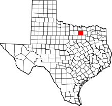 | |
| Towns | ||
| CDPs | ||
| Unincorporated communities | ||
| Ghost towns | ||
| Footnotes | ‡This populated place also has portions in an adjacent county or counties | |
Municipalities and communities of Tarrant County, Texas, United States | ||
|---|---|---|
| Cities |
|  |
| Towns | ||
| CDPs | ||
| Unincorporated communities | ||
| Historical communities | ||
| Ghost towns | ||
| Footnotes | ‡ This populated place also has portions in an adjacent county or counties ‡‡ Previously considered a census-designated place | |