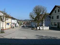
Sankt Peter am Wimberg
| Sankt Peter am Wimberg | ||
|---|---|---|
 | ||
| ||
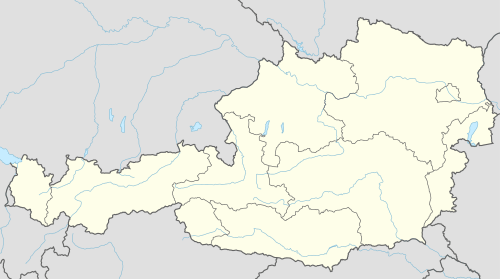 Sankt Peter am Wimberg Location within Austria | ||
| Coordinates: 48°30′10″N 14°05′12″E / 48.50278°N 14.08667°ECoordinates: 48°30′10″N 14°05′12″E / 48.50278°N 14.08667°E | ||
| Country | Austria | |
| State | Upper Austria | |
| District | Rohrbach | |
| Government | ||
| • Mayor | Engelbert Pichler (ÖVP) | |
| Area | ||
| • Total | 23 km2 (9 sq mi) | |
| Elevation | 668 m (2,192 ft) | |
| Population (14 June 2016)[1] | ||
| • Total | 1,777 | |
| • Density | 77/km2 (200/sq mi) | |
| Time zone | CET (UTC+1) | |
| • Summer (DST) | CEST (UTC+2) | |
| Postal code | 4171 | |
| Area code | 07282 | |
| Vehicle registration | RO | |
| Website | www.st-peter-wimberg.ooe.gv.at | |
Sankt Peter am Wimberg is a municipality in the district of Rohrbach in the Austrian state of Upper Austria.
Geography
Sankt Peter lies in the upper Mühlviertel. About 28 percent of the municipality is forest, and 66 percent is farmland.
References
| Wikimedia Commons has media related to Sankt Peter am Wimberg. |
This article is issued from Wikipedia - version of the 10/20/2015. The text is available under the Creative Commons Attribution/Share Alike but additional terms may apply for the media files.