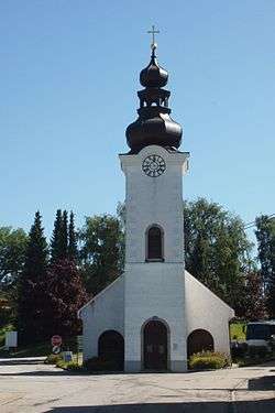
Sankt Oswald bei Freistadt
| Sankt Oswald bei Freistadt | ||
|---|---|---|
 | ||
| ||
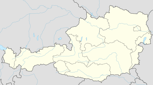 Sankt Oswald bei Freistadt Location within Austria | ||
| Coordinates: 48°30′0″N 14°35′0″E / 48.50000°N 14.58333°ECoordinates: 48°30′0″N 14°35′0″E / 48.50000°N 14.58333°E | ||
| Country | Austria | |
| State | Upper Austria | |
| District | Freistadt | |
| Government | ||
| • Mayor | Alois Punkenhofer (SPÖ) | |
| Area | ||
| • Total | 40.9 km2 (15.8 sq mi) | |
| Elevation | 608 m (1,995 ft) | |
| Population (14 June 2016)[1] | ||
| • Total | 2,873 | |
| • Density | 70/km2 (180/sq mi) | |
| Time zone | CET (UTC+1) | |
| • Summer (DST) | CEST (UTC+2) | |
| Postal code | 4271 | |
| Area code | 07945 | |
| Vehicle registration | FR | |
| Website | www.stoswald.at | |
Sankt Oswald bei Freistadt is a municipality in the district of Freistadt in [Austria]]n state of Upper Austria.
Population
| Historical population | ||
|---|---|---|
| Year | Pop. | ±% |
| 1869 | 1,922 | — |
| 1880 | 1,991 | +3.6% |
| 1890 | 2,089 | +4.9% |
| 1900 | 2,018 | −3.4% |
| 1910 | 2,028 | +0.5% |
| 1923 | 2,009 | −0.9% |
| 1934 | 2,045 | +1.8% |
| 1939 | 2,162 | +5.7% |
| 1951 | 2,238 | +3.5% |
| 1961 | 2,262 | +1.1% |
| 1971 | 2,273 | +0.5% |
| 1981 | 2,296 | +1.0% |
| 1991 | 2,518 | +9.7% |
| 2001 | 2,706 | +7.5% |
References
- ↑ Statistik Austria - Bevölkerung zu Jahresbeginn 2002-2016 nach Gemeinden, Erstellt am 14.06.2016 (Last accessed 13.12.2016) for Sankt Oswald bei Freistadt.
| Wikimedia Commons has media related to Sankt Oswald bei Freistadt. |
This article is issued from Wikipedia - version of the 2/24/2014. The text is available under the Creative Commons Attribution/Share Alike but additional terms may apply for the media files.