Saar-Hunsrück Nature Park


The Saar-Hunsrück Nature Park (German: Naturpark Saar-Hunsrück) was established in 1980 and covers an area of just under 2,000 km² in the German states of Rhineland-Palatinate and the Saarland.
The authority responsible for the nature park is the Saar-Hunsrück Nature Park Society (Verein Naturpark Saar-Hunsrück) with its headquarters in Hermeskeil.[1] In Hermeskeil the society runs an "experience museum" and one of six information centres.
Towns and villages
In the Saarland, the nature park lies wholly within the town boroughs and local municipalities of Perl, Mettlach, Losheim am See, Merzig, Weiskirchen, Wadern, Beckingen, Rehlingen-Siersburg, Wallerfangen, Nonnweiler, Tholey, Nohfelden, Oberthal, Namborn, St. Wendel and Freisen. It also lies partly on the territories of Lebach, in its municipalities of Dörsdorf and Steinbach, the municipality of Schmelz, in its parishes of Dorf, Limbach and Michelbach and within the municipality of Eppelborn, in the parish of Dirmingen.[2]
In Rhineland-Palatinate the nature park lies on parts of the territories of the following boroughs and collective municipalities: Saarburg, Konz, Ruwer, Kell am See, Hermeskeil (Trier-Saarburg), Thalfang, Bernkastel-Kues (Bernkastel-Wittlich), Kirchberg/Hunsrück (Rhein-Hunsrück-Kreis), Rhaunen, Herrstein, Birkenfeld and Baumholder (Birkenfeld) and parts of the free municipality of Morbach (Landkreis Bernkastel-Wittlich) and the large county town of Idar-Oberstein (Birkenfeld).[3]
Core zones
There are seven core zones in the Rhineland –Palatinate part of the park, which are specially protected:[3]
- Mannebach Valley
- Saar Valley-Leukbach Valley
- Osburger Hochwald
- Western part of the Schwarzwalder Hochwald
- Eastern part of the Schwarzwalder Hochwald-Idar Forest
- Neuhof-Abentheuer
- Southeastern Hochwald Kirschweiler/Buhlenberg
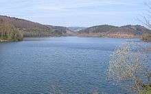
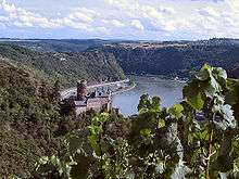
Rivers and streams
|
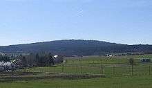
Mountains and hills
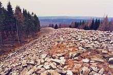
The mountains and hills in the Saar-Hunsrück Nature Park include the following – sorted by height in metres (m) above sea level (Normalnull or NN; unless otherwise stated these are referenced from state map service[4]):
- Erbeskopf (816.32 m[5]), Schwarzwalder Hochwald
- An den zwei Steinen (766.2 m), Idar Forest
- Kahlheid (766 m), Idar Forest
- Sandkopf (756.8 m), Schwarzwalder Hochwald
- Steingerüttelkopf (756.6 m), Idarwald
- Ruppelstein (755.2 m), Schwarzwalder Hochwald
- Idarkopf (745.7 m), Idar Forest
- Usarkopf (725 m), Idar Forest
- Rösterkopf (708.1 m), Osburger Hochwald
- Friedrichskopf (707.4 m[6]), Schwarzwalder Hochwald
Saar-Hunsrück-Steig
One of the nature park's projects is the 218-kilometre-long "premier" long-distance path, the Saar-Hunsrück-Steig[7] from Perl on the border with Luxembourg via Mettlach, Weiskirchen and the Roman city of Trier to the Prims Reservoir, continuing via the Erbeskopf, the circular rampart of Otzenhausen, to the Wildenburger Kopf and finally to Idar-Oberstein.
See also
Literature
- Hans-Martin Braun and Carsten Braun: Saar-Hunsrück Nature Park - Stille Schönheit. Tecklenborg Verlag, Steinfurt, 2002, ISBN 3-934427-25-1
External links
| Wikimedia Commons has media related to Saar-Hunsrück Nature Park. |
- Saar-Hunsrück Nature Park, Hermeskeil
- Literature about the Saar-Hunsrück Nature Park in the Saarländische Bibliographie
References
- ↑ Constitution of the Saar-Hunsrück Nature Park Society
- ↑ Saarländische Verordnung über den „Saar-Hunsrück Nature Park“ vom 1. März 2007, zuletzt geändert durch Verordnung vom 30. Juli 2010
- 1 2 Rhineland-Palatinate State Act for the "Saar-Hunsrück Nature Park" dated 14 February 1980, last amended on 20 July 1985
- ↑ Map service of the Landscape Information System of the Rhineland-Palatinate Nature Conservation Office (Naturschutzverwaltung Rheinland-Pfalz)
- ↑ Article entitled Wie hoch is der Erbeskopf nun wirklich? dated 17 January 2008 at lvermgeo.rlp.de (retrieved 31 January 2013)
- ↑ Map services of the Federal Agency for Nature Conservation
- ↑ Homepage Saar-Hunsrück-Steig, retrieved 24 January 2014
|  | |
Coordinates: 49°34′N 6°46′E / 49.56°N 6.76°E