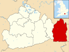
Nutfield, Surrey
| Nutfield | |
.JPG) St Peter and St Paul's Church |
|
 Nutfield |
|
| Area | 9.81 km2 (3.79 sq mi) |
|---|---|
| Population | 2,673 (Civil Parish 2011)[1] |
| – density | 272/km2 (700/sq mi) |
| – London | 18 miles (29 km) |
| Civil parish | Nutfield |
| District | Tandridge |
| Ceremonial county | Surrey |
| Region | South East |
| Country | England |
| Sovereign state | United Kingdom |
| Post town | REDHILL |
| Postcode district | RH1 |
| Dialling code | 01737 |
| Police | Surrey |
| Fire | Surrey |
| Ambulance | South East Coast |
| EU Parliament | South East England |
Coordinates: 51°14′17″N 0°07′59″W / 51.238°N 0.133°W
Nutfield is a village and civil parish in the Tandridge district of Surrey. It lies in the Weald immediately south of the Greensand Ridge and has a railway station at South Nutfield which is one stop from Redhill, on the Redhill to Tonbridge Line. It includes a watersports park, Mercer's Park Country Park.
History
The village lay within the Reigate hundred.
Nutfield appears in Domesday Book of 1086 as Notfelle. It was held by Countess Ida of Boulogne (2nd wife of Count Eustace). Its domesday assets were: 3 hides; 1 church, 16 ploughs, 1 mill worth 2s, 10 acres (40,000 m2) of meadow, herbage worth 12 hogs. It rendered £15 per year to its feudal overlords.[2]
The church is to St Peter and St Paul and is a II* listed building, built in the 13th century, with rebuilt tower in 1786 made of coursed stone to the base of the tower, rubblestone above and Horsham slabs feature in the chancel. It has three bay nave arcades, 13th century, on round piers with corbelled arches, a 14th-century corbelled chancel arch on attached piers with moulded capitals and a blocked 13th century arch to the north chapel. There are continuous mouldings to the tall impressive tower arch. The rubble stone walling is revealed in the chancel. There are two stained glass windows (one strong in blue and green) by Edward Burne-Jones.[3]
Geography
Nutfield Marsh is a community located to the north of the historic east-west route the A25 where the village centre is.
The village centre is also a quite small community, featuring the area of Nutfield Court and its conservation area; it is outsized by the largest part of the community South Nutfield next to the nearest station, Nutfield railway station. The parish council has an unusually great number of large photographs displaying buildings and landscape.[4]
Governance
There is one representative on Surrey County Council, conservative Tony Elias whose physically large ward is called Godstone.[5]
There are three representatives on Tandridge District Council:
| Member Since | Member[6] |
Ward | |
|---|---|---|---|
| 2007 | Gill Black | Bletchingley & Nutfield | |
| 2006 | Tony Edouard Elias | Bletchingley & Nutfield | |
| 1998 | Marian Eva Patricia Myland | Bletchingley & Nutfield | |
The parish council has 8 members.[4]
The parish council was set up in 1894 under the terms of the Local Government Act 1894. The council's work ranges from planning applications, allotments, cemetery, meeting and cultural venues, overgrown footpaths to dog fouling. The Metropolitan Green Belt has been used to retain the largely agricultural green belt around the village of Nutfield.
Transport
At just over a mile, an undulating walk away, is Nutfield railway station in South Nutfield.
The A23 has road junctions to the village in Redhill and Salfords to the west, each 2 miles (3.2 km) away.
Amenities
Within the bounds of Nutfield is the The Aqua Sports Company's Mercers Park country park.
Demography and housing
| Output area | Detached | Semi-detached | Terraced | Flats and apartments | Caravans/temporary/mobile homes | shared between households[1] |
|---|---|---|---|---|---|---|
| (Civil Parish) | 371 | 305 | 254 | 147 | 1 | 0 |
The average level of accommodation in the region composed of detached houses was 28%, the average that was apartments was 22.6%.
| Output area | Population | Households | % Owned outright | % Owned with a loan | hectares[1] |
|---|---|---|---|---|---|
| (Civil Parish) | 2,673 | 1,078 | 35.5% | 41.2% | 981 |
The proportion of households in the civil parish who owned their home outright compares to the regional average of 35.1%. The proportion who owned their home with a loan compares to the regional average of 32.5%. The remaining % is made up of rented dwellings (plus a negligible % of households living rent-free).
Nearest settlements
 |
Merstham | Chaldon | Caterham | |
| Redhill | |
Bletchingley | ||
| ||||
| | ||||
| South Earlswood, Earlswood | South Nutfield, Nutfield | Outwood |
See also
References
- 1 2 3 Key Statistics; Quick Statistics: Population Density United Kingdom Census 2011 Office for National Statistics Retrieved 21 November 2013
- ↑ Surrey Domesday Book
- ↑ "National Heritage List". English Heritage. Retrieved 28 April 2012.
- 1 2 "Parish Council Members". Nutfield Parish Council. Retrieved 28 April 2012.
- ↑ "List of Surrey CC Councillors". Surrey County Council. Retrieved 28 April 2012.
- ↑ "Council Members". Tandridge District Council. Retrieved 28 April 2012.
| Wikimedia Commons has media related to Nutfield, Surrey. |
| Settlements (grouped by associated post town) |
|  | ||||||||||||||||||||||||||||||||||
|---|---|---|---|---|---|---|---|---|---|---|---|---|---|---|---|---|---|---|---|---|---|---|---|---|---|---|---|---|---|---|---|---|---|---|---|---|
| Places of worship | ||||||||||||||||||||||||||||||||||||
| Education | ||||||||||||||||||||||||||||||||||||
| Transport |
| |||||||||||||||||||||||||||||||||||
| Buildings and structures |
| |||||||||||||||||||||||||||||||||||
| Sport |
| |||||||||||||||||||||||||||||||||||
The administrative centre is Oxted. The largest town is Caterham. Three of the post towns have urban centres Caterham, Godstone and Oxted. Lingfield and Warlingham are major villages which have post town status. The others are outside the area. | ||||||||||||||||||||||||||||||||||||