Meridianville, Alabama
| Meridianville, Alabama | |
|---|---|
| Census-designated place (CDP) & Unincorporated community | |
 Location in Madison County and the state of Alabama | |
| Coordinates: 34°52′9″N 86°34′42″W / 34.86917°N 86.57833°W | |
| Country | United States |
| State | Alabama |
| County | Madison |
| Area[1] | |
| • Total | 15.6 sq mi (40.4 km2) |
| • Land | 15.5 sq mi (40.3 km2) |
| • Water | 0.1 sq mi (0.1 km2) |
| Elevation | 791 ft (241 m) |
| Population (2010) | |
| • Total | 6,021 |
| • Density | 262.2/sq mi (101.7/km2) |
| Time zone | Central (CST) (UTC-6) |
| • Summer (DST) | CDT (UTC-5) |
| ZIP code | 35759 |
| Area code(s) | 256 |
| FIPS code | 01-48112 |
| GNIS feature ID | 0122660 |
Meridianville is an unincorporated community and census-designated place (CDP) in Madison County, Alabama, United States, and is included in the Huntsville-Decatur Combined Statistical Area. As of the 2010 census, the population of the community is 6,021.[2]
Geography
Meridianville is located at 34°52′10″N 86°34′42″W / 34.86944°N 86.57833°W (34.869312, -86.578373).[1]
According to the U.S. Census Bureau, the community has a total area of 15.6 square miles (40 km2), of which 15.5 square miles (40 km2) is land and 0.1 square miles (0.26 km2) is water.
Education
- Lynn Fanning Elementary (K-3)
4-6 go to Moores Mill Intermediate School, 7-8 go to Meridianville Middle School and 9-12 Hazel Green High School in nearby Hazel Green.
Demographics
| Historical population | |||
|---|---|---|---|
| Census | Pop. | %± | |
| 1880 | 105 | — | |
| 1980 | 1,403 | — | |
| 1990 | 2,852 | 103.3% | |
| 2000 | 4,117 | 44.4% | |
| 2010 | 6,021 | 46.2% | |
Meridianville first appeared on the 1880 U.S. Census as an unincorporated community of 105 residents. It did not appear again on the census for a century (1980), when it was designated a census designated place (CDP).
As of the census[3] of 2000, there were 4,117 people, 1,492 households, and 1,250 families residing in the community. The population density was 263.0 people per square mile (101.6/km²). There were 1,565 housing units at an average density of 100.0 per square mile (38.6/km²). The racial makeup of the community was 86.62% White, 9.40% Black or African American, 1.07% Native American, 0.73% Asian, 0.05% Pacific Islander, 0.19% from other races, and 1.94% from two or more races. 0.70% of the population were Hispanic or Latino of any race.
There were 1,492 households out of which 40.5% had children under the age of 18 living with them, 72.8% were married couples living together, 8.8% had a female householder with no husband present, and 16.2% were non-families. 14.7% of all households were made up of individuals and 4.6% had someone living alone who was 65 years of age or older. The average household size was 2.76 and the average family size was 3.05.
In the community the population was spread out with 27.5% under the age of 18, 6.3% from 18 to 24, 31.4% from 25 to 44, 25.1% from 45 to 64, and 9.6% who were 65 years of age or older. The median age was 38 years. For every 100 females there were 97.7 males. For every 100 females age 18 and over, there were 96.1 males.
The median income for a household in the community was $54,766, and the median income for a family was $61,367. Males had a median income of $42,274 versus $29,241 for females. The per capita income for the community was $23,626. About 2.9% of families and 4.2% of the population were below the poverty line, including 3.9% of those under age 18 and none of those age 65 or over.
2010 census
As of the census[4] of 2010, there were 6,021 people, 2,248 households, and 1,743 families residing in the community. The population density was 262.2 people per square mile (101.7/km²). There were 2,353 housing units at an average density of 151.8 per square mile (58.4/km²). The racial makeup of the community was 76.3% White, 18.5% Black or African American, .7% Native American, 1.7% Asian, 0.2% Pacific Islander, 0.7% from other races, and 2.0% from two or more races. 2.7% of the population were Hispanic or Latino of any race.
There were 2,248 households out of which 33.8% had children under the age of 18 living with them, 63.7% were married couples living together, 10.1% had a female householder with no husband present, and 22.5% were non-families. 19.3% of all households were made up of individuals and 6.3% had someone living alone who was 65 years of age or older. The average household size was 2.68 and the average family size was 3.08.
In the community the population was spread out with 25.6% under the age of 18, 6.9% from 18 to 24, 26.5% from 25 to 44, 28.9% from 45 to 64, and 12.0% who were 65 years of age or older. The median age was 38.9 years. For every 100 females there were 93.4 males. For every 100 females age 18 and over, there were 91.4 males.
The median income for a household in the community was $68,864, and the median income for a family was $76,449. Males had a median income of $55,956 versus $36,100 for females. The per capita income for the community was $26,834. About 2.4% of families and 5.8% of the population were below the poverty line, including 5.8% of those under age 18 and 6.4% of those age 65 or over.
References
- 1 2 "US Gazetteer files: 2010, 2000, and 1990". United States Census Bureau. 2011-02-12. Retrieved 2011-04-23.
- ↑ "American FactFinder". United States Census Bureau. Retrieved 2011-05-14.
- ↑ "American FactFinder". United States Census Bureau. Retrieved 2008-01-31.
- ↑ "American FactFinder". United States Census Bureau. Retrieved 2015-08-02.
Coordinates: 34°52′10″N 86°34′42″W / 34.869312°N 86.578373°W
Municipalities and communities of Madison County, Alabama, United States | ||
|---|---|---|
| Cities | 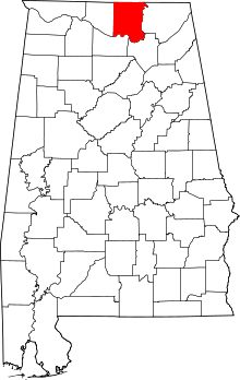 | |
| Towns | ||
| CDPs | ||
| Unincorporated communities | ||
| Footnotes | ‡This populated place also has portions in an adjacent county or counties | |