Linton, Quebec
| Linton | |
|---|---|
| Unorganized territory | |
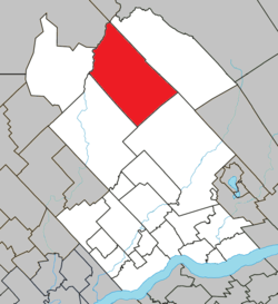 Location within Portneuf RCM. | |
 Linton Location in central Quebec. | |
| Coordinates: 47°15′N 72°15′W / 47.250°N 72.250°WCoordinates: 47°15′N 72°15′W / 47.250°N 72.250°W[1] | |
| Country |
|
| Province |
|
| Region | Capitale-Nationale |
| RCM | Portneuf |
| Constituted | unspecified |
| Government[2] | |
| • Federal riding | Portneuf—Jacques-Cartier |
| • Prov. riding | Portneuf |
| Area[2][3] | |
| • Total | 463.10 km2 (178.80 sq mi) |
| • Land | 437.60 km2 (168.96 sq mi) |
| Population (2011)[3] | |
| • Total | 0 |
| • Density | 0.0/km2 (0/sq mi) |
| • Pop 2006-2011 |
|
| • Dwellings | 234 |
| Time zone | EST (UTC−5) |
| • Summer (DST) | EDT (UTC−4) |
| Highways | No major routes |
Linton is an unorganized territory in the Capitale-Nationale region of Quebec, Canada, in the north of the Portneuf Regional County Municipality. It is named after the hamlet of Linton that is located along the Canadian National Railway and the Batiscan River (47°15′34″N 72°14′41″W / 47.25944°N 72.24472°W).
Demographics
Population trend:[4]
- Population in 2011: 0 (2006 to 2011 population change: -100.0 %)
- Population in 2006: 32
- Population in 2001: 0
- Population in 1996: 0
- Population in 1991: 0
Private dwellings occupied by usual residents: 0 (total dwellings: 234)
References
- ↑ Reference number 149634 of the Commission de toponymie du Québec (French)
- 1 2 Ministère des Affaires municipales, des Régions et de l'Occupation du territoire - Répertoire des municipalités: Linton
- 1 2 Statistics Canada 2011 Census - Linton census profile
- ↑ Statistics Canada: 1996, 2001, 2006, 2011 census
 |
La Tuque | Lac-Blanc | | |
| Lac-Lapeyrère | |
|||
| ||||
| | ||||
| Rivière-à-Pierre | Saint-Raymond |
| Cities & towns | |
|---|---|
| Municipalities | |
| Parishes | |
| Unorganized territories | |
| |
This article is issued from Wikipedia - version of the 1/25/2014. The text is available under the Creative Commons Attribution/Share Alike but additional terms may apply for the media files.