Kunturiri (Linares)
This article is about the mountain in the José María Linares Province, Potosí Department, Bolivia. For other uses, see Kunturiri.
| Kunturiri | |
|---|---|
 Kunturiri Location in Bolivia | |
| Highest point | |
| Elevation | 4,867 m (15,968 ft) [1] |
| Coordinates | 19°44′42″S 65°37′56″W / 19.74500°S 65.63222°WCoordinates: 19°44′42″S 65°37′56″W / 19.74500°S 65.63222°W |
| Geography | |
| Location |
Bolivia, Potosí Department |
| Parent range | Andes, Potosí mountain range |
Kunturiri (Aymara kunturi condor,[2] -(i)ri a suffix, Hispanicized spelling Condoriri) is a 4,867-metre-high (15,968 ft) mountain in the Potosí mountain range in the Bolivian Andes. It is situated south-east of Potosí in the Potosí Department, José María Linares Province, in the west of the Puna Municipality. Kunturiri lies south of the mountain Jatun Kunturiri and west of the lake T'ala Qucha.[1][3]
References
Capital: Potosí | ||
| Provinces | 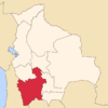 | |
| Municipalities (and seats) |
| |
This article is issued from Wikipedia - version of the 5/5/2016. The text is available under the Creative Commons Attribution/Share Alike but additional terms may apply for the media files.