Jatun Kunturiri
| Jatun Kunturiri | |
|---|---|
 Jatun Kunturiri Location in Bolivia | |
| Highest point | |
| Elevation | 5,008 m (16,430 ft) [1] |
| Coordinates | 19°43′12″S 65°38′13″W / 19.72000°S 65.63694°WCoordinates: 19°43′12″S 65°38′13″W / 19.72000°S 65.63694°W |
| Geography | |
| Location |
Bolivia, Potosí Department |
| Parent range | Andes, Potosí mountain range |
Jatun Kunturiri (Quechua hatun, in Bolivia always jatun big, great,[2] Aymara kunturi condor,[3] -ri Aymara suffix, hispanicized spellings Jatun Condoriri, Jatún Condoriri) is a mountain in the Potosí mountain range of the Bolivian Andes, about 5,008 m (16,430 ft) high. It is situated south-east of Potosí in the Potosí Department, José María Linares Province, in the south-west of the Puna Municipality. It lies between the Sip'uruni River in the north and the Khunurana in the south, north-west of the lake T'ala Qucha and the village Talaco.[4][5][6]
See also
References
- ↑ Evelio Echevarría, Cordillera de Potosí, Bolivia, The Alpine Journal, 1995
- ↑ Teofilo Laime Ajacopa, Diccionario Bilingüe Iskay simipi yuyayk'ancha, La Paz, 2007 (Quechua-Spanish dictionary)
- ↑ aymara.ucb.edu.bo Félix Layme Payrumani, Spanish-Aymara dictionary: CÓNDOR (<a). Ave rapaz diurna mas grande de todas. - Kunturi, fig. mallku.
- ↑ "Puna". INE, Bolivia. Retrieved October 6, 2014. (unnamed)
- ↑ Bolivian IGM map 1:50,000 6434-I Puna
- ↑ lib.utexas.edu Map of the area
Capital: Potosí | ||
| Provinces | 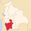 | |
| Municipalities (and seats) |
| |
This article is issued from Wikipedia - version of the 10/26/2016. The text is available under the Creative Commons Attribution/Share Alike but additional terms may apply for the media files.