Karan Nagar
| Karan Nagar کرن نگر | |
|---|---|
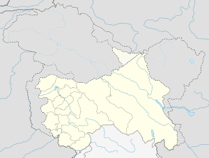
 Karan Nagar Location in Jammu and Kashmir, India | |
| Coordinates: 34°4′45″N 74°47′59″E / 34.07917°N 74.79972°ECoordinates: 34°4′45″N 74°47′59″E / 34.07917°N 74.79972°E | |
| District | Srinagar district |
| Settled | Ancient |
| Elevation | 1,592 m (5,223 ft) |
| Languages | |
| • Official | Urdu, Kashmiri |
| Time zone | IST (UTC+5:30) |
| PIN | 190010 |
| Distance from Delhi | 857 kilometres (533 mi) |
| Distance from Mumbai | 2,182.4 kilometres (1,356.1 mi) |
Karan Nagar (Urdu; کرن نگر) is the notified area and the town in the city of Srinagar in the Indian administered Jammu and Kashmir. The area is located about 2 km from the commercial center of Kashmir.The town is named after the son of Maharaja Hari Sing's son Dr. Karan Singh.
History
The town had the decent population of Kashmiri Pandits before their exile in last decade of twentieth century. The town is named after the Hindu name Karan. At present Muslims dominate the population of the area at an estimated percentage of 99.9%.
Demographics
Kashmiri is the local language in the area, people also use English and Urdu as the official languages of the area.
Geography
The area is located 34°04′45″N 74°47′56″E / 34.0791°N 74.799°E 2 km towards north from District headquarters of Srinagar. The area is bounded by Lal Chowk towards South, Batmaloo towards West, Safa Kadal towards North and Nawabazar towards East.The area is situated at an elevation of 1592 m above mean sea level in Mumbai.[1]
See also
References
- ↑ "wikimapia.org". Retrieved 17 January 2015.