Soura, Kashmir
| Soura | |
|---|---|
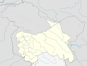 Soura  Soura Location in Jammu and Kashmir, India | |
| Coordinates: 34°8′1″N 74°48′6″E / 34.13361°N 74.80167°ECoordinates: 34°8′1″N 74°48′6″E / 34.13361°N 74.80167°E | |
| District | Srinagar district |
| Settled | Ancient |
| Elevation | 1,592 m (5,223 ft) |
| Languages | |
| • Official | Urdu, Kashmiri |
| Time zone | IST (UTC+5:30) |
| PIN | 190011 |
| Telephone code | 0194 |
| Vehicle registration | JK |
| Distance from Delhi | 858.9 kilometres (533.7 mi) |
| Distance from Mumbai | 2,206.7 kilometres (1,371.2 mi) |
Soura is a notified area of Srinagar located about 11.1 km north of Lal Chowk on Srinagar-Ladakh Highway.[1] Soura is famous for Sher-i-Kashmir Institute of Medical Sciences Hospital, a multi-speciality hospital. Besides serving as a Hospital, it is the prestigious medical college of Kashmir valley. Soura is located near Anchar Lake. The whole western side of the area is covered by Anchar Lake.[2][3] During the period of Buddhism in Kashmir, a Buddhist Vihara was built at "Saurasa", corresponding to the place "Sowur" (Soura) on the shore of Anchar Lake to the north of Srinagar. It also hosts a famous Muslim shrine known as Aasaar Sharief Jinaab Saahib which holds more than 13 holy relics.
Education
The area is considered as one of the key education centres in the city. The following is the list of colleges and schools in the area:
- Sher-i-Kashmir Institute of Medical Sciences. The college provides course in MBBS. It has 100 seats which are filled by J&K state board for entrance examination by selecting the candidates which qualify Common Entrance Test.[4]
- Government Boys Higher Secondary
- Government Girls Higher Secondary
- Standard Public High School
- Ramzan Memorial Public School
- Mother Land public school
- Iqbal Public School
- Mahad Al-Lugat-ul Arabia
See also
References
- ↑ http://www.googlemaps.com
- ↑ "Floods in Kashmir, Army called out". The Times of India. Sep 4, 2006.
- ↑ http://wikimapia.org/11370559/Soura-Medical-College
- ↑ Handbook of Jammu and Kashmir State Board for entrance examination/Medical Colleges.