Hilbert, Wisconsin
| Hilbert, Wisconsin | |
|---|---|
| Village | |
 | |
 Location of Hilbert, Wisconsin | |
| Coordinates: 44°8′24″N 88°9′44″W / 44.14000°N 88.16222°WCoordinates: 44°8′24″N 88°9′44″W / 44.14000°N 88.16222°W | |
| Country | United States |
| State | Wisconsin |
| County | Calumet |
| Area[1] | |
| • Total | 1.44 sq mi (3.73 km2) |
| • Land | 1.44 sq mi (3.73 km2) |
| • Water | 0 sq mi (0 km2) |
| Elevation[2] | 837 ft (255 m) |
| Population (2010)[3] | |
| • Total | 1,132 |
| • Estimate (2012[4]) | 1,133 |
| • Density | 786.1/sq mi (303.5/km2) |
| Time zone | Central (CST) (UTC-6) |
| • Summer (DST) | CDT (UTC-5) |
| Zip Code | 54129 |
| Area code(s) | 920 |
| FIPS code | 55-34575[5] |
| GNIS feature ID | 1566405[2] |
| Website |
villageofhilbert |
Hilbert is a village in Calumet County in the U.S. state of Wisconsin. The population was 1,132 at the 2010 census.
Geography
Hilbert is located at 44°8′24″N 88°9′44″W / 44.14000°N 88.16222°W (44.140040, -88.162250).[6]
According to the United States Census Bureau, the village has a total area of 1.44 square miles (3.73 km2), all of it land.[1]
Demographics
| Historical population | |||
|---|---|---|---|
| Census | Pop. | %± | |
| 1900 | 497 | — | |
| 1910 | 572 | 15.1% | |
| 1920 | 614 | 7.3% | |
| 1930 | 519 | −15.5% | |
| 1940 | 607 | 17.0% | |
| 1950 | 648 | 6.8% | |
| 1960 | 736 | 13.6% | |
| 1970 | 896 | 21.7% | |
| 1980 | 1,176 | 31.3% | |
| 1990 | 1,211 | 3.0% | |
| 2000 | 1,089 | −10.1% | |
| 2010 | 1,132 | 3.9% | |
| Est. 2015 | 1,106 | [7] | −2.3% |
2010 census
As of the census[3] of 2010, there were 1,132 people, 462 households, and 302 families residing in the village. The population density was 786.1 inhabitants per square mile (303.5/km2). There were 482 housing units at an average density of 334.7 per square mile (129.2/km2). The racial makeup of the village was 93.8% White, 1.3% Native American, 3.8% from other races, and 1.1% from two or more races. Hispanic or Latino of any race were 7.9% of the population.
There were 462 households of which 32.3% had children under the age of 18 living with them, 51.9% were married couples living together, 6.9% had a female householder with no husband present, 6.5% had a male householder with no wife present, and 34.6% were non-families. 27.7% of all households were made up of individuals and 13% had someone living alone who was 65 years of age or older. The average household size was 2.45 and the average family size was 3.02.
The median age in the village was 38.3 years. 24.7% of residents were under the age of 18; 8.8% were between the ages of 18 and 24; 26.4% were from 25 to 44; 26% were from 45 to 64; and 14.1% were 65 years of age or older. The gender makeup of the village was 51.1% male and 48.9% female.
2000 census
As of the census[5] of 2000, there were 1,089 people, 430 households, and 288 families residing in the village. The population density was 982.8 people per square mile (378.8/km²). There were 458 housing units at an average density of 413.4 per square mile (159.3/km²). The racial makeup of the village was 98.26% White, 0.09% Native American, 0.73% Asian, 0.73% from other races, and 0.18% from two or more races. Hispanic or Latino of any race were 1.47% of the population.
There were 430 households out of which 33.3% had children under the age of 18 living with them, 54.4% were married couples living together, 6.5% had a female householder with no husband present, and 33.0% were non-families. 28.8% of all households were made up of individuals and 14.7% had someone living alone who was 65 years of age or older. The average household size was 2.53 and the average family size was 3.14.
In the village the population was spread out with 27.2% under the age of 18, 8.8% from 18 to 24, 27.9% from 25 to 44, 22.8% from 45 to 64, and 13.3% who were 65 years of age or older. The median age was 36 years. For every 100 females there were 98.7 males. For every 100 females age 18 and over, there were 94.8 males.
The median income for a household in the village was $42,938, and the median income for a family was $51,591. Males had a median income of $35,357 versus $22,826 for females. The per capita income for the village was $18,872. About 1.0% of families and 3.7% of the population were below the poverty line, including 3.1% of those under age 18 and 10.1% of those age 65 or over.
Notable residents
- Bunny Berigan, jazz trumpeter, was born in Hilbert (disputed).
Gallery
 Driving northbound through Hilbert on Highway 57
 Welcome sign
 Sargento plant
References
- 1 2 "US Gazetteer files 2010". United States Census Bureau. Archived from the original on January 24, 2012. Retrieved 2012-11-18.
- 1 2 "US Board on Geographic Names". United States Geological Survey. 2007-10-25. Retrieved 2008-01-31.
- 1 2 "American FactFinder". United States Census Bureau. Retrieved 2012-11-18.
- ↑ "Population Estimates". United States Census Bureau. Archived from the original on June 17, 2013. Retrieved 2013-06-24.
- 1 2 "American FactFinder". United States Census Bureau. Retrieved 2008-01-31.
- ↑ "US Gazetteer files: 2010, 2000, and 1990". United States Census Bureau. 2011-02-12. Retrieved 2011-04-23.
- ↑ "Annual Estimates of the Resident Population for Incorporated Places: April 1, 2010 to July 1, 2015". Retrieved July 2, 2016.
- ↑ "Census of Population and Housing". Census.gov. Archived from the original on May 11, 2015. Retrieved June 4, 2015.
External links
Municipalities and communities of Calumet County, Wisconsin, United States | ||
|---|---|---|
| Cities | 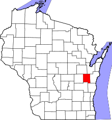 | |
| Villages | ||
| Towns | ||
| CDP | ||
| Unincorporated communities | ||
| Ghost town | ||
| Footnotes | ‡This populated place also has portions in an adjacent county or counties | |