Franktown, Colorado
| Franktown, Colorado | |
|---|---|
| Census-designated place | |
 Location in Douglas County and the state of Colorado | |
| Coordinates: 39°23′25″N 104°45′14″W / 39.39028°N 104.75389°WCoordinates: 39°23′25″N 104°45′14″W / 39.39028°N 104.75389°W | |
| Country |
|
| State |
|
| County | Douglas[1] |
| Area | |
| • Total | 2.96 sq mi (7.66 km2) |
| • Land | 2.94 sq mi (7.62 km2) |
| • Water | 0.02 sq mi (0.04 km2) |
| Elevation[1] | 6,161 ft (1,878 m) |
| Population (2010) | |
| • Total | 395 |
| • Density | 134/sq mi (51.8/km2) |
| Time zone | MST (UTC-7) |
| • Summer (DST) | MDT (UTC-6) |
| ZIP code[2] | 80116 |
| Area code(s) | 303 and 720 |
| FIPS code | 08-28250 |
| GNIS feature ID | 0204741 |
Franktown is an unincorporated community and census-designated place (CDP) in Douglas County, Colorado, in the United States. The population was 395 at the 2010 census.[3][4] The Franktown Post Office has the ZIP code 80116.[2]
History
Franktown is named for Hon. J. Frank Gardner, an early resident.[5][6] Franktown was the first county seat of Douglas County, serving in this role from 1861 until 1863.
Pike's Peak Grange No. 163 in Franktown is listed on the National Register of Historic Places.
Geography
Franktown is located in eastern Douglas County at 39°23′25″N 104°45′14″W / 39.39028°N 104.75389°W (39.390378, -104.753961).[7] Colorado State Highways 83 and 86 intersect in the center of town. SH 83 leads north 9 miles (14 km) to Parker and south 45 miles (72 km) to Colorado Springs, while SH 86 leads east 9 miles (14 km) to Elizabeth and west 7 miles (11 km) to Castle Rock, the Douglas County seat.
According to the United States Census Bureau, the Franktown CDP has a total area of 3.0 square miles (7.7 km2), of which 0.02 square miles (0.04 km2), or 0.47%, is water.[8] Franktown is in the valley of Cherry Creek, which flows north to join the South Platte River in downtown Denver.
Demographics
As of the census[4] of 2000, there were 99 people, 38 households, and 29 families residing in the CDP. The population density was 116.8 people per square mile (45.0/km²). There were 38 housing units at an average density of 44.8 per square mile (17.3/km²). The racial makeup of the CDP was 97.98% White, 1.01% from other races, and 1.01% from two or more races. Hispanic or Latino of any race were 1.01% of the population.
There were 38 households out of which 28.9% had children under the age of 18 living with them, 73.7% were married couples living together, 2.6% had a female householder with no husband present, and 21.1% were non-families. 21.1% of all households were made up of individuals and 7.9% had someone living alone who was 65 years of age or older. The average household size was 2.61 and the average family size was 3.00.
In the CDP the population was spread out with 21.2% under the age of 18, 8.1% from 18 to 24, 26.3% from 25 to 44, 36.4% from 45 to 64, and 8.1% who were 65 years of age or older. The median age was 43 years. For every 100 females there were 94.1 males. For every 100 females age 18 and over, there were 85.7 males.
The median income for a household in the CDP was $60,375, and the median income for a family was $61,500. Males had a median income of $61,528 versus $30,139 for females. The per capita income for the CDP was $25,744. None of the population was below the poverty line.
See also
- Outline of Colorado
- State of Colorado
- Cherry Creek Rockshelter
- Franktown Cave, prehistorical archaeological site
References
- 1 2 "US Board on Geographic Names". United States Geological Survey. 2007-10-25. Retrieved 2008-01-31.
- 1 2 "ZIP Code Lookup" (JavaScript/HTML). United States Postal Service. December 14, 2006. Retrieved December 14, 2006.
- ↑ Colorado Trend Report 2: State and Complete Places (Sub-state 2010 Census Data). Missouri Census Data Center. Accessed 2011-02-25.
- 1 2 "American FactFinder". United States Census Bureau. Retrieved 2008-01-31.
- ↑ Gannett, Henry (1905). The Origin of Certain Place Names in the United States. Govt. Print. Off. p. 131.
- ↑ Dawson, John Frank. Place names in Colorado: why 700 communities were so named, 150 of Spanish or Indian origin. Denver, CO: The J. Frank Dawson Publishing Co. p. 22.
- ↑ "US Gazetteer files: 2010, 2000, and 1990". United States Census Bureau. 2011-02-12. Retrieved 2011-04-23.
- ↑ "Geographic Identifiers: 2010 Demographic Profile Data (G001): Franktown CDP, Colorado". U.S. Census Bureau, American Factfinder. Retrieved October 16, 2015.
External links
Municipalities and communities of Douglas County, Colorado, United States | ||
|---|---|---|
| Cities | 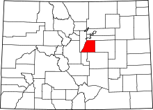 | |
| Towns | ||
| CDPs | ||
| Unincorporated communities | ||
| Footnotes | ‡This populated place also has portions in an adjacent county or counties | |