Ewing Township, Franklin County, Illinois
| Ewing Township | |
|---|---|
| Township | |
 Location in Franklin County | |
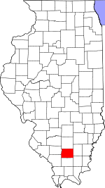 Franklin County's location in Illinois | |
| Coordinates: 38°04′45″N 88°52′42″W / 38.07917°N 88.87833°WCoordinates: 38°04′45″N 88°52′42″W / 38.07917°N 88.87833°W | |
| Country | United States |
| State | Illinois |
| County | Franklin |
| Established | November 4, 1884 |
| Area | |
| • Total | 38.02 sq mi (98.5 km2) |
| • Land | 35.9 sq mi (93 km2) |
| • Water | 2.12 sq mi (5.5 km2) 5.58% |
| Elevation | 472 ft (144 m) |
| Population (2010) | |
| • Total | 1,345 |
| • Density | 37.5/sq mi (14.5/km2) |
| Time zone | CST (UTC-6) |
| • Summer (DST) | CDT (UTC-5) |
| ZIP codes | 62812, 62836, 62846, 62897 |
| GNIS feature ID | 0428984 |
Ewing Township is one of twelve townships in Franklin County, Illinois, USA. As of the 2010 census, its population consisted of 1,345 in 657 households.[1]
Geography
According to the 2010 census, the township has a total area of 38.02 square miles (98.5 km2), of which 35.9 square miles (93 km2) (or 94.42%) is land and 2.12 square miles (5.5 km2) (or 5.58%) is water.[1] The east portion of the Wayne Fitzgerrell State Recreation Area is in this township, as is Rend Lake.
Cities, towns, villages
School Districts
Ewing-Northern Grade School 115
Unincorporated towns
- Benton Park
- Whittington
(This list is based on USGS data and may include former settlements.)
Cemeteries
The township contains these nine cemeteries: Cypher, Franklin, King, Miller, Overturf, Phillips, Shiloh, Thurmond and Winemiller.
Major highways
Airports and landing strips
- Rend Lake Conservancy District Heliport
Political districts
- Illinois' 12th congressional district
- State House District 117
- State Senate District 59
References
- "Ewing Township, Franklin County, Illinois". Geographic Names Information System. United States Geological Survey. Retrieved 2010-01-16.
- United States Census Bureau 2007 TIGER/Line Shapefiles
- United States National Atlas
- 1 2 "Population, Housing Units, Area, and Density: 2010 - County -- County Subdivision and Place -- 2010 Census Summary File 1". United States Census. Retrieved 2013-05-28.
External links

Municipalities and communities of Franklin County, Illinois, United States | ||
|---|---|---|
| Cities | ||
| Villages | ||
| Townships | ||
| CDP | ||
| Other unincorporated communities | ||
This article is issued from Wikipedia - version of the 12/9/2015. The text is available under the Creative Commons Attribution/Share Alike but additional terms may apply for the media files.