Dundurn, Saskatchewan
| Dundurn | |
|---|---|
| Town | |
|
Dundurn's Business District: 2nd Street | |
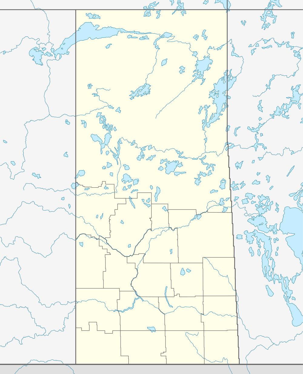 Dundurn  Dundurn Location of Dundurn in Saskatchewan | |
| Coordinates: 51°49′N 106°30′W / 51.817°N 106.500°W | |
| Country | Canada |
| Provinces and territories of Canada | Saskatchewan |
| Rural Municipalities (R.M.) | Dundurn No. 314 |
| Post office Founded in NWT | 1894-09-01 |
| Village | 1905 |
| Town | 1980 |
| Government | |
| • Mayor | Narraway, Doug (2008) |
| Area | |
| • Land | .88 km2 (0.34 sq mi) |
| Population (2006) | |
| • Total | 647 |
| • Density | 736.88/km2 (1,908.5/sq mi) |
| Website | Official website |
| [1][2][3][4] | |

Dundurn is a town of 647 residents in the rural municipality of Dundurn No. 314, in the Canadian province of Saskatchewan. Dundurn is located on Highway 11 or Louis Riel Trail in central Saskatchewan, about 42 km south of Saskatoon. As well as being an agricultural town, it is also a bedroom community for both Camp Dundurn and Saskatoon.
History
The Regina Branch CNR rail line came through in 1889.[5]
Demographics
| Canada census – Dundurn, Saskatchewan community profile | |||
|---|---|---|---|
| 2011 | 2006 | 2001 | |
| Population: | 693 (7.1% from 2006) | 647 (8.6% from 2001) | 596 (25.2% from 1996) |
| Land area: | 1.37 km2 (0.53 sq mi) | 0.88 km2 (0.34 sq mi) | 0.88 km2 (0.34 sq mi) |
| Population density: | 505.3/km2 (1,309/sq mi) | 736.8/km2 (1,908/sq mi) | 676.8/km2 (1,753/sq mi) |
| Median age: | 34.8 (M: 35.0, F: 34.8) | 34.5 (M: 34.8, F: 34.0) | 36.0 (M: 36.2, F: 35.9) |
| Total private dwellings: | 263 | 251 | 251 |
| Median household income: | $55,836 | $40,716 | |
| References: 2011[6] 2006[7] 2001[8] | |||
Area statistics
- Lat (DMS) 51° 49' 00" N
- Long (DMS) 106° 30' 00" W
- Dominion Land Survey Sec.32, Twp.32, R.4, W3 in 1894 / Sec.9, Twp.33, R.4, W3
- Time zone (cst) UTC−6
Economy
In 2012, Brightenview Development International proposed the development of North America's largest wholesale centre in the town.[9] The Dundurn International Exhibition Centre will provide a showcase for 350 Chinese businesses intending to sell home decor items and building materials to wholesalers, contractors/builders, retailers and consumers.[10]
Education
Students in kindergarten to grade six are able to attend school at Dundurn Elementary School.[11] After graduation, students can acquire further education in Hanley, Saskatchewan at Hanley Composite School, which is a kindergarten to grade 12 school.[12]
Sites of interest
- Blackstrap Provincial park and Blackstrap Ski Hill a conservation area with man made lake as well as a man made mountain is located 7 kilometers or 5 miles to the east of town. In 1969, 1970 Mount Blackstrap was constructed to host the 1971 Canada Winter Games which were awarded to Saskatoon. The land used to create the mountain later became the reserve for Lake Blackstrap.[13]
- Bradwell National Wildlife Area, another conservation area is located 20 kilometers or 12 miles north east of town.
- Camp Dundurn of Canadian Forces Base CFB Dundurn featuring the 17th Wing Detachment of the Canadian Armed Forces is 6 kilometers or 4 miles north of Dundurn.
- The unincorporated areas of Indi, Strehlow, and Haultain are located within 10 kilometers of Dundurn, but not much is left of these rail towns and sidings.
- Whitecap Dakota First Nation (Chief Whitecap 94 Indian reserve) is 15 km (9 miles) north west of Dundurn.
- Dakota Dunes Casino and associated Dakota Dunes Links Golf course is nearby. The casino and convention centre opened in 2007.
- The roadside attractions Bone Gatherer and Horse and Wagon are two additions on the Louis Riel Trail [14][15]
- Wilson Museum which is hosted in three buildings one of which is the Woodview School is located in the town of Dundurn.[16]
Heritage buildings
The town has three designated heritage properties:
- Dundurn Community Centre (formerly Dundurn School or Old Brick School) - The building was built in 1916, by the Bigelow Bros. with R. M. Thomson as the architect. The building served as a school from 1916 until 1980. Today the building is used as a community centre.[17]
- Old Bank Building (formally Northern Bank; Northern Crown Bank; Dundurn Post Office) - Originally built 1906 as a two story wood-frame bank building housing the Northern Bank (Canada), Northern Crown Bank and Royal Bank. The building housed a post office from 1935 until 1957.[18]
- Dundurn Moravian Brethren Church (also called the United Church of Dundurn building) - The church was constructed as a joint church building housing the Anglican, Methodist, Presbyterian, and Moravian members communities. The church was a joint-stock company owned by the member denominations.[19]
Government
Dundurn is run under a mayor-council form of civic governance.
References
- ↑ National Archives, Archivia Net. "Post Offices and Postmasters". Retrieved 2007-05-26.
- ↑ Government of Saskatchewan, MRD Home. "Municipal Directory System". Retrieved 2014-07-06.
- ↑ Canadian Textiles Institute. (2005). "CTI Determine your provincial constituency". Retrieved 2007-05-26.
- ↑ Commissioner of Canada Elections, Chief Electoral Officer of Canada (2005). "Elections Canada On-line". Retrieved 2007-04-24.
- ↑ Adamson, J. "Canadian Maps: May 1948 Waghorn's Guide. Post Offices in Man. Sask. Alta. and West Ontario". Canadian Maps Online Digitization Project. Retrieved 2007-06-02.
- ↑ "2011 Community Profiles". Canada 2011 Census. Statistics Canada. July 5, 2013. Retrieved 2012-07-07.
- ↑ "2006 Community Profiles". Canada 2006 Census. Statistics Canada. March 30, 2011. Retrieved 2011-03-06.
- ↑ "2001 Community Profiles". Canada 2001 Census. Statistics Canada. February 17, 2012. Retrieved 2011-03-06.
- ↑ Davis, Jeff (2012-12-18). "Dundurn megamall would be largest in North America". Leader-Post. Retrieved 2012-12-18.
- ↑ "Massive shopping complex proposed for Dundurn". CBC. 2012-12-07. Retrieved 2012-12-18.
- ↑ "Dundurn School". WordPress. 2014-09-17. Retrieved 2014-09-17.
- ↑ "Hanley Composite School". WordPress. 2014-09-17. Retrieved 2014-09-17.
- ↑ "Welcome to Dundurn, Saskatchewan, Canada". Archived from the original on 2007-09-29. Retrieved 2007-06-02.
- ↑ Richard Donnan. "Bone Gatherer Dundurn, Saskatchewan". LARGE CANADIAN ROADSIDE ATTRACTIONS. Retrieved 2007-06-02.
- ↑ Ernie Wlock. "Horse and Wagon Dundurn, Saskatchewan". LARGE CANADIAN ROADSIDE ATTRACTIONS. Retrieved 2007-06-02.
- ↑ "Town of Dundurn Tourist Attractions". Archived from the original on 2007-09-29. Retrieved 2007-06-02.
- ↑ Dundurn Community Centre
- ↑ Old Bank Building
- ↑ http://heritageapp.cyr.gov.sk.ca/assets/pdf/33.pdf
External links
- Town of Dundurn
- Saskatchewan Elevators: Dundurn
- Army - News Joint Canadian-US training at Dundurn, Saskatchewan
- Dundurn Mennonite Church (Dundurn, Sask.)
- Resurfacing complete on Highway 11 north of Dundurn - Government ...
 |
Grasswood-Saskatoon | | ||
| South Saskatchewan River-Whitecap Dakota/Sioux First Nation | |
Thode-Shields | ||
| ||||
| | ||||
| Hanley-Kenaston |
Coordinates: 51°48′35″N 106°30′27″W / 51.80959°N 106.50763°W