Campion, Colorado
| Campion, Colorado | |
|---|---|
| Unincorporated community | |
 Campion, Colorado Location within the state of Colorado | |
| Coordinates: 40°20′54″N 105°5′21″W / 40.34833°N 105.08917°WCoordinates: 40°20′54″N 105°5′21″W / 40.34833°N 105.08917°W | |
| Country |
|
| State |
|
| County | Larimer County |
| Area | |
| • Total | 3.8 sq mi (9.8 km2) |
| • Land | 3.8 sq mi (9.8 km2) |
| • Water | 0.0 sq mi (.1 km2) |
| Elevation[1] | 5,118 ft (1,560 m) |
| Population (2000) | |
| • Total | 1,832 |
| • Density | 485.5/sq mi (187.6/km2) |
| Time zone | MST (UTC-7) |
| • Summer (DST) | MDT (UTC-6) |
| ZIP code | 80537 (Loveland) |
| FIPS code | 08-11590 |
| GNIS feature ID | 0178078 |
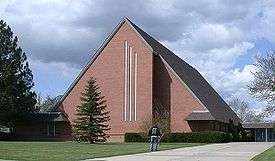
Campion is an unincorporated community in Larimer County, Colorado, United States.[2] The population was 1,832 at the 2000 census, at which time it was a census-designated place (CDP); the community was not enumerated separately in the 2010 census.[2] Located between Loveland and Berthoud along U.S. Route 287, it was named for John F. Campion, a railroad official.[3]
Geography
Campion is located in the northern part of Colorado between Denver, CO and Cheyenne, WY at 40°20′54″N 105°5′21″W / 40.34833°N 105.08917°W (40.348257, -105.089095).[4]
According to the United States Census Bureau, the CDP had a total area of 3.8 square miles (9.8 km2), of which 3.8 square miles (9.8 km2) was land and 0.04 square miles (0.10 km2) or .53 percent was water.
Demographics
As of the census[5] of 2000, there were 1,832 people, 641 households, and 510 families residing in the CDP. The population density was 485.5 people per square mile (187.6/km²). There were 653 housing units at an average density of 173.0 per square mile (66.9/km²). The racial makeup of the CDP was 92.19% White, 0.11% African American, 1.20% Native American, 0.82% Asian, 3.28% from other races, and 2.40% from two or more races. Hispanic or Latino of any race were 7.48% of the population.
There were 641 households out of which 41.0% had children under the age of 18 living with them, 69.3% were married couples living together, 6.2% had a female householder with no husband present, and 20.3% were non-families. 15.3% of all households were made up of individuals and 4.4% had someone living alone who was 65 years of age or older. The average household size was 2.86 and the average family size was 3.20.
In the CDP the population was spread out with 28.9% under the age of 18, 6.8% from 18 to 24, 28.8% from 25 to 44, 27.1% from 45 to 64, and 8.4% who were 65 years of age or older. The median age was 38 years. For every 100 females there were 102.9 males. For every 100 females age 18 and over, there were 102.0 males.
The median income for a household in the CDP was $51,813, and the median income for a family was $53,611. Males had a median income of $42,563 versus $26,719 for females. The per capita income for the CDP was $21,812. 2.5% of the population and 3.6% of families were below the Out of the total population, none of those under the age of 18 and none of those 65 and older are living below the poverty line.
See also
References
- ↑ "US Board on Geographic Names". United States Geological Survey. 2007-10-25. Retrieved 2008-01-31.
- 1 2 Colorado Trend Report 2: State and Complete Places (Sub-state 2010 Census Data). Missouri Census Data Center. Accessed 2011-02-25.
- ↑ Dawson, John Frank (1954). Place names in Colorado: why 700 communities were so named, 150 of Spanish or Indian origin. Denver, CO: The J. Frank Dawson Publishing Co. p. 12.
- ↑ "US Gazetteer files: 2010, 2000, and 1990". United States Census Bureau. 2011-02-12. Retrieved 2011-04-23.
- ↑ "American FactFinder". United States Census Bureau. Archived from the original on 2013-09-11. Retrieved 2008-01-31.
Municipalities and communities of Larimer County, Colorado, United States | ||
|---|---|---|
| Cities | 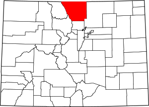 | |
| Towns | ||
| CDPs | ||
| Unincorporated communities | ||
| Ghost towns | ||
| Footnotes | ‡This populated place also has portions in an adjacent county or counties | |