Blue Rock Township, Muskingum County, Ohio
| Blue Rock Township, Muskingum, Ohio | |
|---|---|
| Township | |
|
Cutler Lake at Blue Rock State Park | |
 Location of Blue Rock Township in Muskingum County | |
| Coordinates: 39°48′47″N 81°51′3″W / 39.81306°N 81.85083°WCoordinates: 39°48′47″N 81°51′3″W / 39.81306°N 81.85083°W | |
| Country | United States |
| State | Ohio |
| County | Muskingum |
| Area | |
| • Total | 27.3 sq mi (70.7 km2) |
| • Land | 27.0 sq mi (70.0 km2) |
| • Water | 0.3 sq mi (0.7 km2) |
| Elevation[1] | 1,060 ft (323 m) |
| Population (2000) | |
| • Total | 641 |
| • Density | 23.7/sq mi (9.2/km2) |
| Time zone | Eastern (EST) (UTC-5) |
| • Summer (DST) | EDT (UTC-4) |
| ZIP code | 43720 |
| Area code(s) | 740 |
| FIPS code | 39-07398[2] |
| GNIS feature ID | 1086714[1] |

Blue Rock Township is one of the twenty-five townships of Muskingum County, Ohio, United States. The 2000 census found 641 people in the township.[3]
Geography
Located on the southern edge of the county, it borders the following townships:
- Salt Creek Township - north
- Rich Hill Township - northeast corner
- Meigs Township - east
- Bristol Township, Morgan County - southeast corner
- Bloom Township, Morgan County - south
- Harrison Township - west
- Wayne Township - northwest
No municipalities are located in Brush Creek Township, although the unincorporated community of Blue Rock lies in the western part of the township.
Name and history
Blue Rock Township took its name from Blue Rock Creek.[4] It is the only Blue Rock Township statewide.
By the 1830s, Blue Rock Township had a sawmill and at least ten salt factories.[5]
Government
The township is governed by a three-member board of trustees, who are elected in November of odd-numbered years to a four-year term beginning on the following January 1. Two are elected in the year after the presidential election and one is elected in the year before it. There is also an elected township fiscal officer,[6] who serves a four-year term beginning on April 1 of the year after the election, which is held in November of the year before the presidential election. Vacancies in the fiscal officership or on the board of trustees are filled by the remaining trustees.
References
- 1 2 "US Board on Geographic Names". United States Geological Survey. 2007-10-25. Retrieved 2008-01-31.
- ↑ "American FactFinder". United States Census Bureau. Archived from the original on 2013-09-11. Retrieved 2008-01-31.
- ↑ Muskingum County, Ohio — Population by Places Estimates Ohio State University, 2007. Accessed 15 May 2007.
- ↑ Everhart, F.J. (1882). 1794. History of Muskingum County, Ohio, with illustrations and biographical sketches of prominent men and pioneers. F.J. Everhart & Co. p. 426.
- ↑ Kilbourn, John (1833). "The Ohio Gazetteer, or, a Topographical Dictionary". Scott and Wright. p. 101. Retrieved 12 December 2013.
- ↑ §503.24, §505.01, and §507.01 of the Ohio Revised Code. Accessed 4/30/2009.
External links
Municipalities and communities of Muskingum County, Ohio, United States | ||
|---|---|---|
| City | 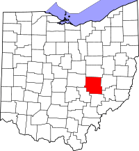 | |
| Villages | ||
| Townships | ||
| CDPs | ||
| Unincorporated communities |
| |
| Footnotes | ‡This populated place also has portions in an adjacent county or counties | |