Amherstdale, West Virginia
| Amherstdale, West Virginia | |
|---|---|
| Census-designated place | |
 Amherstdale, West Virginia | |
| Coordinates: 37°47′07″N 81°48′33″W / 37.78528°N 81.80917°WCoordinates: 37°47′07″N 81°48′33″W / 37.78528°N 81.80917°W | |
| Country | United States |
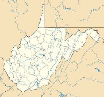
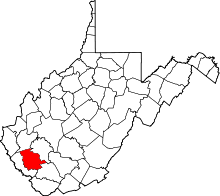
| State | West Virginia |
| County | Logan |
| Area[1] | |
| • Total | 2.970 sq mi (7.69 km2) |
| • Land | 2.952 sq mi (7.65 km2) |
| • Water | 0.018 sq mi (0.05 km2) |
| Elevation | 896 ft (273 m) |
| Population (2010)[2] | |
| • Total | 350 |
| • Density | 120/sq mi (46/km2) |
| Time zone | Eastern (EST) (UTC-5) |
| • Summer (DST) | EDT (UTC-4) |
| ZIP code | 25607 |
| Area code(s) | 304 & 681 |
| GNIS feature ID | 1534919[3] |
Amherstdale is a census-designated place in Logan County, West Virginia, United States, along Buffalo Creek.[4] Its population was 350 as of the 2010 census.[2] Prior to 2010, Amherstdale was part of the Amherstdale-Robinette CDP. Amherstdale has a post office with ZIP code 25607.[5]
References
- ↑ "US Gazetteer files: 2010, 2000, and 1990". United States Census Bureau. 2011-02-12. Retrieved 2011-04-23.
- 1 2 "American FactFinder". United States Census Bureau. Archived from the original on 2013-09-11. Retrieved 2011-05-14.
- ↑ U.S. Geological Survey Geographic Names Information System: Amherstdale, West Virginia
- ↑ West Virginia Atlas & Gazetteer. Yarmouth, Me.: DeLorme. 1997. p. 58. ISBN 0-89933-246-3.
- ↑ United States Postal Service (2012). "USPS - Look Up a ZIP Code". Retrieved 2012-02-15.
This article is issued from Wikipedia - version of the 10/11/2016. The text is available under the Creative Commons Attribution/Share Alike but additional terms may apply for the media files.