Palo Colorado Canyon, California
| Palo Colorado Canyon | |
|---|---|
| Unincorporated community | |
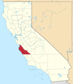
 Palo Colorado Canyon  Palo Colorado Canyon Location in California | |
| Coordinates: 36°23′58″N 121°53′17.5″W / 36.39944°N 121.888194°WCoordinates: 36°23′58″N 121°53′17.5″W / 36.39944°N 121.888194°W | |
| Country | United States |
| State | California |
| County | Monterey County |
| Elevation[1] | 112 ft (34 m) |
Palo Colorado Canyon is an unincorporated community in the Big Sur region of Monterey County, California.[1] The canyon entrance is located at the former settlement of Notley's Landing 6.5 miles (10 km) north of Point Sur,[2] at an elevation of 112 feet (34 m).[1]
History
Early homesteaders in the Palo Colorado Canyon region included Samuel L. Trotter (January 23, 1914),[3] George Notley (March 21, 1896),[4] and his brother William F. Notley (May 8, 1901),[5]
William Notley took over Mortan's patent. Swetnam and Trotter worked for the Notley brothers, who harvested Redwood in the Santa Cruz area and expanded operations to include tanbark in the mountains around Palo Colorado Canyon. Swetnam married Adelaide Pfeiffer and bought the Notley home at the mouth of Palo Colorado Canyon for their residence. He also constructed two cabins and a small barn on his patent along the Little Sur River at the site of the future Pico Blanco camp.
Current residents
As of 2004, there were about 300 households in the Palo Colorado Canyon area. The residents raised $300,000 to build a firehouse to house the Mid-Coast Fire Brigade, an all-volunteer unit that offers fire protection to the area.[6] The canyon was heavily impacted by the 2016 Soberanes Fire, and 57 homes were destroyed in the area by the fire.[7][8]
Government
At the county level, Palo Colorado Canyon is represented on the Monterey County Board of Supervisors by Supervisor Dave Potter.[9]
In the California State Legislature, Palo Colorado Canyon is in the 17th Senate District, represented by Democrat Bill Monning, and in the 30th Assembly District, represented by Democrat Anna Caballero.[10]
In the United States House of Representatives, Palo Colorado Canyon is in California's 20th congressional district, represented by Democrat Sam Farr[11]
References
- 1 2 3 U.S. Geological Survey Geographic Names Information System: Palo Colorado Canyon, California
- ↑ Durham, David L. (1998). California's Geographic Names: A Gazetteer of Historic and Modern Names of the State. Clovis, Calif.: Word Dancer Press. p. 930. ISBN 1-884995-14-4.
- ↑ "Samuel M Trotter, Patent #CASF--0005429". The Land Patents. Retrieved 28 July 2016.
- ↑ "George A Notley, Patent #CACAAA-090763". The Land Patents. Retrieved 28 July 2016.
- ↑ "William F Notley, Patent #CACAAA-092695". The Land Patents. Retrieved 28 July 2016.
- ↑ Howe, Kevin. "Palo Colorado Canyon, California Station To Go Up". Firehouse.com. Retrieved 7 September 2016.
- ↑ "Homes in Palo Colorado Canyon destroyed by wildfire". KWBW. Retrieved September 6, 2015.
- ↑ Handy, Ryan Maye; Gabbert, Bill. "Damage assessment teams document 57 homes destroyed in Soberanes Fire". WildFireToday.com. Retrieved 7 September 2016.
- ↑ "Monterey County Supervisorial District 5 Map (North District 5)" (PDF). County of Monterey. Retrieved 21 September 2012.
- ↑ "Statewide Database". UC Regents. Retrieved February 11, 2015.
- ↑ "California's 20th Congressional District - Representatives & District Map". Civic Impulse, LLC. Retrieved September 24, 2014.