Yuraq Q'asa (Bolivia)
This article is about the mountain in the Potosí Department, Bolivia. For other uses, see Yuraq Q'asa.
| Yuraq Q'asa | |
|---|---|
 Yuraq Q'asa Location within Bolivia | |
| Highest point | |
| Elevation | 4,320 m (14,170 ft) [1] |
| Coordinates | 19°45′12″S 65°48′41″W / 19.75333°S 65.81139°WCoordinates: 19°45′12″S 65°48′41″W / 19.75333°S 65.81139°W |
| Geography | |
| Location |
Bolivia, Potosí Department |
| Parent range | Andes |
Yuraq Q'asa (Quechua yuraq white, q'asa mountain pass,[2] "white pass", also spelled Yuraj Kasa) is a mountain in the Bolivian Andes which reaches a height of approximately 4,320 m (14,170 ft). It is located in the Potosí Department, at the border of the Antonio Quijarro Province, Porco Municipality, and the Tomás Frías Province, Potosí Municipality. The Misk'i Mayu flows along its eastern slope. It is a left tributary of the Jatun Mayu.[1][3]
References
Capital: Potosí | ||
| Provinces | 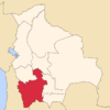 | |
| Municipalities (and seats) |
| |
This article is issued from Wikipedia - version of the 5/3/2016. The text is available under the Creative Commons Attribution/Share Alike but additional terms may apply for the media files.