Wokha
| Wokha | |
|---|---|
| city | |
 Wokha Location in Nagaland, India | |
| Coordinates: 26°06′N 94°16′E / 26.1°N 94.27°ECoordinates: 26°06′N 94°16′E / 26.1°N 94.27°E | |
| Country |
|
| State | Nagaland |
| District | Wokha |
| Elevation | 1,313 m (4,308 ft) |
| Population (2011)[1] | |
| • Total | 70,008 |
| • Rank | 3rd in Nagaland |
| Languages | |
| • Official | English |
| Time zone | IST (UTC+5:30) |
| Vehicle registration | NL |
| Website |
nagaland |
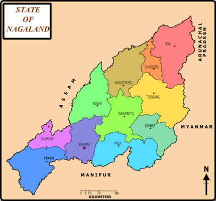
Wokha district, declared as 'the land of plenty' by the state government of Nagaland, due to her rich mineral resources, soil fertility and abounding flora and fauna, is located at the latitude of 26°8° North and Longitude of 94°18° East. The district is situated at an economically strategic location sharing borders with Assam in the West and North, Kohima and Dimapur in the South, Zunheboto in the East and Mokokchung in the North East.
Wokha literally means "head count" or "census" in Lotha dialect. It has a geographical area of 1628 Square kilometers constituting 9.82 percent of the State geographical area and a population of 1,66,343 with a literacy rate of 87.68 percent. The district is dominantly inhabited by the Lotha tribe.
The district has four assembly constituencies and 125 recognized villages. It is further divided into 13 administrative units and 7 rural development blocks. It has three ranges namely, Upper Range covering the Wokha, Wozhuro, Chukitong and Englan circle; Middle range covering the Lotsu, Sanis and Aitepyong circle and lower range covering the Bhandari Circle and Ralan area.
History
Wokha was made as the district headquarters of the Naga hills under Assam by the British in 1876. By 1878 the headquarters was shifted to Kohima, but Wokha remained a subdivision. Later in 1889 the subdivision was shifted to Mokokchung. After India's independence, Wokha became a sub division in 1957 under Naga Hills Tuensang Area, and remained so till she became a district in 1973.
Geography and climate
Wokha is located at 26°06′N 94°16′E / 26.1°N 94.27°E[2] at an average elevation of 1,313 metres (4,793 feet). It has a warm temperate climate (classified as Cwa by Köppen and Geiger). The summer temperature of Wokha ranges from 16.1 °C to 32 °C. The winter temperature reaches a minimum of 2 °C. The average annual temperature in Wokha is 17.8 °C. The average annual rainfall is 1940 mm.
Demographics
Wokha is the third largest town in Nagaland after Dimapur and Kohima. According to the 2011 census, the population is 70,004. Wokha has an average literacy rate of 85.67%; male literacy is 86.98%, while female literacy is 84.26%. In Wokha, 10.57% of the population is under 6 years of age. Kyong (Lotha) is the most widely used language for communication, while Nagamese (broken Assamese) and English are also used with non-locals. The majority of the population is Christian, mostly adhering to the Baptist denomination.
Tourism
Wokha's agglomeration consists of Wokha town, Longsa village, Wokha village and Vakhosung. It has a combined population of over 80,000. Wokha is on the main route from Kohima to Mokokchung and was one of the earliest locations of the Assam Rifles. The Government of Nagaland constructed a tourist lodge in Wokha Town. The annual Amur falcon migration passes Doyang Dam, which is a 2-hour drive away. It also hosts the oldest cricket tournament in North East India, The Winter Cricket Challenge. The nearest railhead is Furkating Railway Station in Golaghat, Assam and the nearest airport is Dimapur Airport (IATA: DMU, ICAO: VEMR). Taxis and buses are available from every district headquarter in Nagaland to Wokha. There is a helicopter service from Dimapur.
Myths
Mount Tiyi is a hill which has supernatural legends associated with it. Most Nagas believe that this mountain is the abode of departed souls. According to local Lotha folklore, the mountain had an orchard that could only be found by the 'lucky ones.' Rhododendrons are common on Mount Tiyi.
References
- ↑ "Census of India: Search Details". Censusindia.gov.in. Retrieved 20 October 2014.
- ↑ "Falling Rain Genomics, Inc - Wokha". Fallingrain.com. Retrieved 20 October 2014.