Wila Salla (Bolivia)
This article is about the mountain in the Potosí Department, Bolivia. For other uses, see Wila Salla (disambiguation).
| Wila Salla | |
|---|---|
 Wila Salla Location within Bolivia | |
| Highest point | |
| Elevation | 4,784 m (15,696 ft) [1] |
| Coordinates | 19°16′44″S 65°58′43″W / 19.27889°S 65.97861°WCoordinates: 19°16′44″S 65°58′43″W / 19.27889°S 65.97861°W |
| Geography | |
| Location | Bolivia, Potosí Department, Tomás Frías Province |
| Parent range | Andes |
Wila Salla (Aymara wila red, salla rocks, cliffs,[2][3] "red rocks") is a 4,784 m (15,696 ft) high mountain in the Andes of Bolivia. It is located in the Potosí Department, Tomás Frías Province, on the border of the municipalities of Tinguipaya and Yocalla.[4]
References
- ↑ Bolivian IGM map 1:50,000 Tinguipaya 6436-III
- ↑ Radio San Gabriel, "Instituto Radiofonico de Promoción Aymara" (IRPA) 1993, Republicado por Instituto de las Lenguas y Literaturas Andinas-Amazónicas (ILLLA-A) 2011, Transcripción del Vocabulario de la Lengua Aymara, P. Ludovico Bertonio 1612 (Spanish-Aymara-Aymara-Spanish dictionary)
- ↑ "Diccionario Quechua - Aymara al español". katari.org. Retrieved January 31, 2016.
- ↑ "Tinquipaya". INE, Bolivia. Retrieved January 31, 2016.
Capital: Potosí | ||
| Provinces | 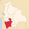 | |
| Municipalities (and seats) |
| |
This article is issued from Wikipedia - version of the 1/31/2016. The text is available under the Creative Commons Attribution/Share Alike but additional terms may apply for the media files.