Vakkom
| Vakkom | |
|---|---|
| village | |
 Vakkom  Vakkom Location in Kerala, India | |
| Coordinates: 8°41′N 76°46′E / 8.69°N 76.77°ECoordinates: 8°41′N 76°46′E / 8.69°N 76.77°E | |
| Country |
|
| State | Kerala |
| District | Thiruvananthapuram |
| Talukas | Chirayinkeezhu |
| Government | |
| • Body | Gram panchayat |
| • Panchayat President | S Venuji |
| Area | |
| • Total | 5.6 km2 (2.2 sq mi) |
| Population (2001) | |
| • Total | 20,899 |
| • Density | 3,700/km2 (9,700/sq mi) |
| Languages | |
| • Official | Malayalam |
| Time zone | IST (UTC+5:30) |
| PIN | 695308[1] |
| Telephone code | 91 (0)470 |
| Vehicle registration | KL 16 |
| Literacy | 90.6%% |
| Lok Sabha constituency | Chirayinkil |
| Vidhan Sabha constituency | Attingal |
| Distance from Thiruvananthapuram | 35 kilometres (22 mi) N (land) |
| Distance from Attingal | 8 kilometres (5.0 mi) W (land) |
| Distance from Kollam | 48 kilometres (30 mi) S (land) |
Vakkom വക്കം (in Malayalam) is a village near Kadakkavoor in Thiruvananthapuram district of Kerala, India.[2] It is 35 km north of Thiruvananthapuram, the state capital. Vakkom panchayat is surrounded by back waters (Kayal). Neighbouring panchayats are Anjengo, Kadakkavoor, Vettoor, Cherunniyoor and Manampoor. The towns within 9 km are Varkala and Attingal. The nearest airport is Trivandrum International Airport and Kadakkavoor (1 km) is the nearest railway station.
The total area of Vakkom is 5.06 km2.
At the 2011 India census, Vakkom had a population of 19,267 with 8,319 males and 10,948 females.[3]
Notable residents
- Vakkom Moulavi (1873 - 1932), Islamic renaissance leader, social reformer, Muslim scholar, Educationist and the founder of Swadeshabhimani newspaper.
- Vakkom Majeed (1909-2000), Indian freedom fighter, politician and a former member of the Travancore-Cochin State Assembly.
- INA Hero Khader (1917-1943), Indian freedom fighter and Indian National Army member who hanged by the British Government in 1943.
- Vakkom Purushothaman (1928-), Indian Politician, former governor of Mizoram and Andaman and Nicobar Islands.
References
- ↑ "India Post: Pincode Search". Retrieved 16 December 2008.
- ↑ "Census of India : Villages with population 5000 & above". Registrar General & Census Commissioner, India. Retrieved 10 December 2008.
- ↑ Census India 2011
District HQ: Thiruvananthapuram | |||||||||||
| History | 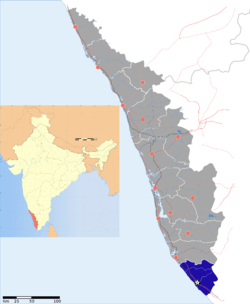 | ||||||||||
| Geography | |||||||||||
| Cities and Taluks |
| ||||||||||
| Transport | |||||||||||
| Education |
| ||||||||||
| Buildings | |||||||||||
| Culture | |||||||||||
| Lok Sabha constituencies | |||||||||||
| Sports | |||||||||||
| Museums | |||||||||||
This article is issued from Wikipedia - version of the 10/20/2016. The text is available under the Creative Commons Attribution/Share Alike but additional terms may apply for the media files.