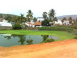
Tuni
| Tuni తుని | |
|---|---|
| Town | |
 | |
 Tuni Location in Andhra Pradesh, India | |
| Coordinates: 17°21′N 82°33′E / 17.35°N 82.55°ECoordinates: 17°21′N 82°33′E / 17.35°N 82.55°E | |
| Country | India |
| State | Andhra Pradesh |
| Region | Coastal Andhra |
| District | East Godavari |
| Area[1] | |
| • Total | 9.85 km2 (3.80 sq mi) |
| Elevation | 140 m (460 ft) |
| Population (2011)[2] | |
| • Total | 53,425 |
| • Density | 5,400/km2 (14,000/sq mi) |
| Languages | |
| • Official | Telugu |
| Time zone | IST (UTC+5:30) |
| PIN | 533401 |
| Telephone code | 91–8854 |
| Vehicle registration | AP 05 |

Tuni is a town in East Godavari district of the Indian state of Andhra Pradesh. It is a major commercial marketing center for more than forty surrounding villages in the district. Tuni is border point for the district of East Godavari. Tuni is known for mango export, with nearly 250 varieties of mangoes. It is also famous for betel leaves, jute bags, Cashew nuts are major produced variety in Tuni.
History
Tuni may be a historical site dated back to 1st century CE in connection with Buddhism, which flourished in the nearby hillocks and villages such as Gopalapatnam, Satyavaram and KummariLova nearby to the city of Tuni on the banks of Thandava River. The Buddhist monks would have resided in Kummarilova village (Kummararam) from the 2nd century CE to 6th century CE and propagated Buddhism. The Buddhist 'aramas' and 'stupas' found in the village are testimony for their presence, they said. This village is being called 'Panchasheela Buddhist centre' as five Buddhist 'stupas' were found here in recent times. Archaeology authorities have found a Buddhist site at Kummarilova of Tuni during a general survey carried out recently in the area.
Modern History is in connection with the Kshatriyas of Vatsavai Dynasty, where it was a PARGANA(a sub-division in 15 th Century) in Keemarseema, and after the division it became the capital of KOTTAM ESTATE, Tuni is a famous marketplace since 19th century CE. Tuni Railway station has an important prominence on the Howrah-Madras railway line during the time of British India and also after Independence. Raja kalasala in Tuni is one of the oldest school in Tuni, which is having a history of more than 100 years. One of the prominent guerrilla war fighter at the time of Bharat independence, Alluri seetharamaraju, has studied in the same school. As a respect for him, a statue of him was built at a junction.
Demographics
As per 2011 Census, Tuni Municipality has population of 53,425 of which 25,922 are males while 27,503 are females. Literacy rate of Tuni city is 77.40% higher than state average of 67.02% with Male literacy rate of 82.79% while female literacy rate is 72.38 %[3]
Geography
Tuni is located at 17.35°N 82.55°E. It has an average elevation of 16 metres (46 ft)
Economy
A famous and one of the oldest sugar factories of Andhra Pradesh Tandava sugars is located here.A large number of handloom industries, about a 20 cashew nut industries ,hetero industries and other 10 chemical industries are located in and around Tuni.
Assembly constituency
Tuni is an assembly constituency (consisting of Mandals : Kotananduru, Tuni and Thondangi) in Andhra Pradesh. There were 163,024 registered voters in Tuni constituency in 1999 elections.
Transport

National Highway 5,a part of golden quadrilateral passes through the city. The Andhra Pradesh State Road Transport Corporation operates bus services from Tuni bus station.[4] Tuni lies on the major line of Vijayawada–Visakhapatnam line being a part of Chennai–Howrah line. Nearest airport is Visakhapatnam Airport, at 100 km drive. Annavaram, which is a sacred place of Lord Veera Venkata Satyanarayana Swamy is just a 19 km drive from Tuni.
Education
The primary and secondary school education is imparted by government, aided and private schools, under the School Education Department of the state.[5][6] The medium of instruction followed by different schools are English, Telugu.
Notable people
- Alluri Sita Rama Raju, a freedom fighter
- Avasarala Ramakrishna Rao, a Telugu short story writer[7]
References
- ↑ "Municipalities, Municipal Corporations & UDAs" (PDF). Directorate of Town and Country Planning. Government of Andhra Pradesh. Archived from the original (PDF) on 28 January 2016. Retrieved 28 January 2016.
- ↑ "Census 2011". The Registrar General & Census Commissioner, India. Retrieved 9 July 2014.
- ↑ "Census of India Website : Office of the Registrar General & Census Commissioner, India". www.censusindia.gov.in. Retrieved 2016-02-09.
- ↑ "Bus Stations in Districts". Andhra Pradesh State Road Transport Corporation. Retrieved 9 March 2016.
- ↑ "School Eduvation Department" (PDF). School Education Department, Government of Andhra Pradesh. Retrieved 7 November 2016.
- ↑ "The Department of School Education - Official AP State Government Portal | AP State Portal". www.ap.gov.in. Retrieved 7 November 2016.
- ↑ Staff Reporter (29 October 2011). "Writer Avasarala Ramakrishna Rao dead". The Hindu. The Hindu. Retrieved 1 March 2015.