Stura del Monferrato
| Stura del Monferrato | |
|---|---|
 | |
 Location within Po watershed | |
| Country | Italy |
| Basin | |
| Main source |
near Moransengo (Province of Asti) 400 m (1,300 ft) |
| River mouth | Po near Pontestura (Province of Alessandria) |
| Physical characteristics | |
| Length | 36.7 km (22.8 mi)[1] |
| Discharge |
|
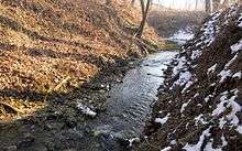
The Stura del Monferrato (also known as the Stura piccola and the Stura di Casale,[3] in each case to distinguish it from other Piedmontese watercourses of the same name: the Stura di Lanzo, the Stura di Demonte and the Stura di Ovada) is a 36.7-kilometre (22.8 mi) stream, which runs through Murisengo, Cerrina Monferrato, Mombello Monferrato and Pontestura in the Italian Province of Alessandria.
A right tributary of the Po River it flows in a northeasterly direction within the hilly region of the Basso Monferrato, through the Val Cerrina. (This valley, however, was not formed by the Stura: rather it was excavated by the major watercourse of Piedmont which existed during the Lower Pleistocene, draining the western Alps and following an east-south-easterly course generally to the south of today’s Po.[4])
Its mean discharge of a mere 3.2 cubic metres per second (110 cu ft/s) relies immediately upon precipitation, and is subject to marked seasonal variations.
Notes
- This article, as of 3 December 2009, was a free translation of its counterpart in the Italian Wikipedia: specifically this version.
- ↑ Caratterizzazione bacini Idrografici (elab.I.a/5) - Allegato tecnico al Piano di Tutela delle Acque (Regione Piemonte, 1 July 2004).
- ↑ Piano di Tutela delle Acque - Revisione del 1° luglio 2004; Caratterizzazione bacini Idrografici (Regione Piemonte, 1 July 2004).
- ↑ G. Nicolucci, ‘La stirpe ligure in Italia ne’ Tempi antichi e ne’ moderni’, Atti della r. Accademia delle scienze fisiche e matematiche, series 1, vol. II, number 1 (Napoli: Stamperia del Fibreno, 1865), p. 18.
- ↑ Massimo Dragonero, Relazione geologica geomorfologica, Progetto Parchi in qualità’ (ENEA, 28 March 2003), p. 9.
Coordinates: 45°08′55″N 8°20′51″E / 45.14861°N 8.34750°E