Muttenhorn
Not to be confused with Mutthorn.
| Muttenhorn | |
|---|---|
 The Mutthorn seen from the north-west side | |
| Highest point | |
| Elevation | 3,099 m (10,167 ft) |
| Prominence | 292 m (958 ft) [1] |
| Parent peak | Pizzo Rotondo |
| Coordinates | 46°32′47.5″N 8°25′38″E / 46.546528°N 8.42722°ECoordinates: 46°32′47.5″N 8°25′38″E / 46.546528°N 8.42722°E |
| Geography | |
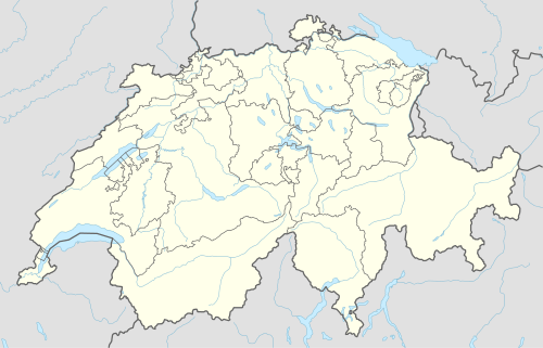 Muttenhorn Location in Switzerland | |
| Location | Valais/Uri, Switzerland |
| Parent range | Lepontine Alps |
The Muttenhorn is a mountain in the Lepontine Alps, located on the border between the cantons of Valais and Uri. At 3,099 metres above sea level, it overlooks the south side of Furka Pass. A glacier named Muttgletscher lies over its north-western flanks, above 2,600 metres.
The summit is also distinguished by the name Gross Muttenhorn, with other lower summits being named Chli Muttenhorn (3,024 metres) and Stotzig Muttenhorn (3,062 metres). The whole range is referred to as the Muttenhörner.
References
External links
This article is issued from Wikipedia - version of the 5/9/2016. The text is available under the Creative Commons Attribution/Share Alike but additional terms may apply for the media files.