Sirk'i (Potosí)
This article is about the mountain in the Potosí Department, Bolivia. For other uses, see Sirk'i.
| Sirk'i | |
|---|---|
 Sirk'i Location in Bolivia | |
| Highest point | |
| Elevation | 5,108 m (16,759 ft) [1] |
| Coordinates | 19°39′31″S 66°27′12″W / 19.65861°S 66.45333°WCoordinates: 19°39′31″S 66°27′12″W / 19.65861°S 66.45333°W |
| Geography | |
| Location |
Bolivia, Potosí Department |
| Parent range | Andes |
Sirk'i (Aymara for wart,[2] also spelled Serkhe, also named Tacaneri or Takañeri) is a 5,108-metre-high (16,759 ft) mountain in the Andes of Bolivia. It is situated in the Potosí Department, Antonio Quijarro Province, Tomave Municipality, about 14 km north of the Jatun Mundo Quri Warani (Nuevo Mundo) volcano. Sirk'i lies southwest of Kunturiri Mayqu and west of Ch'iyar Jaqhi.[1][3]
See also
References
- 1 2 BIGM map 1.50,000 6335-III Cerro Keucha
- ↑ Radio San Gabriel, "Instituto Radiofonico de Promoción Aymara" (IRPA) 1993, Republicado por Instituto de las Lenguas y Literaturas Andinas-Amazónicas (ILLLA-A) 2011, Transcripción del Vocabulario de la Lengua Aymara, P. Ludovico Bertonio 1612 (Spanish-Aymara-Aymara-Spanish dictionary)
- ↑ "Tomave". INE, Bolivia. Retrieved September 7, 2014. (unnamed)
Capital: Potosí | ||
| Provinces | 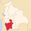 | |
| Municipalities (and seats) |
| |
This article is issued from Wikipedia - version of the 4/29/2016. The text is available under the Creative Commons Attribution/Share Alike but additional terms may apply for the media files.