Sipaliwini Airstrip
| Sipaliwini Airstrip | |||||||||||
|---|---|---|---|---|---|---|---|---|---|---|---|
| IATA: none – ICAO: SMSI | |||||||||||
| Summary | |||||||||||
| Airport type | Public | ||||||||||
| Operator | Luchtvaartdienst Suriname | ||||||||||
| Location | Sipaliwini District, Suriname | ||||||||||
| Elevation AMSL | 744 ft / 227 m | ||||||||||
| Coordinates | 2°01′35″N 56°07′35″W / 2.02639°N 56.12639°WCoordinates: 2°01′35″N 56°07′35″W / 2.02639°N 56.12639°W | ||||||||||
| Map | |||||||||||
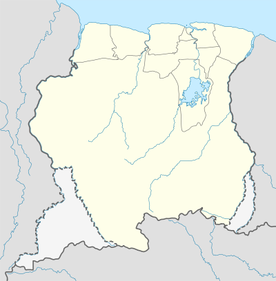 SMSI Location in Suriname | |||||||||||
| Runways | |||||||||||
| |||||||||||
Sipaliwini Airstrip (IATA: SMSI), near the village of Sipaliwini, in the most southern part of Suriname in the Sipaliwini District. It was constructed as part of Operation Grasshopper and the runway of the airstrip was publicly opened in 1962.
The marked runway is 530 metres (1,740 ft) long, and has another 800 metres (2,600 ft) of unobstructed grass within the field boundaries on the east end.
Charters and destinations
Charter Airlines serving this airport are:
| Airlines | Destinations |
|---|---|
| Blue Wing Airlines | Paramaribo, Zorg en Hoop Airport[3] |
| Caricom Airways | Paramaribo, Zorg en Hoop Airport |
| Gum Air | Paramaribo, Zorg en Hoop Airport[4] |
| Hi-Jet Helicopter Services | Paramaribo, Zorg en Hoop Airport |
| Suriname Air Force/ Surinaamse Luchtmacht | Paramaribo, Zorg en Hoop Airport |
| Surinaamse Medische Zendings Vliegdienst/MAF | Paramaribo, Zorg en Hoop Airport |
See also
 Suriname portal
 Aviation portal
- List of airports in Suriname
- Transport in Suriname
References
- ↑ Airport information for SMSI at Great Circle Mapper.
- ↑ Bing Maps - Aerial view
- ↑ Blue Wing schedule
- ↑ Gum Air destinations
External links
This article is issued from Wikipedia - version of the 12/4/2016. The text is available under the Creative Commons Attribution/Share Alike but additional terms may apply for the media files.