Silla Q'asa (Potosí)
This article is about the mountain in the Potosí Department, Bolivia. For other uses, see Silla Q'asa.
| Silla Q'asa | |
|---|---|
 Silla Q'asa Location within Bolivia | |
| Highest point | |
| Elevation | 4,662 m (15,295 ft) [1] |
| Coordinates | 19°41′18″S 65°57′42″W / 19.68833°S 65.96167°WCoordinates: 19°41′18″S 65°57′42″W / 19.68833°S 65.96167°W |
| Geography | |
| Location |
Bolivia, Potosí Department |
| Parent range | Andes |
Silla Q'asa (Quechua silla gravel, q'asa mountain pass,[2] "gravel pass", also spelled Silla Khasa) is a 4,662-metre-high (15,295 ft) mountain in the Bolivian Andes. It is located in the Potosí Department, Antonio Quijarro Province, Porco Municipality.[1][3]
References
Capital: Potosí | ||
| Provinces | 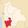 | |
| Municipalities (and seats) |
| |
This article is issued from Wikipedia - version of the 5/2/2016. The text is available under the Creative Commons Attribution/Share Alike but additional terms may apply for the media files.