Siku (Bolivia)
For the musical instrument, see Siku (instrument).
| Siku | |
|---|---|
 Siku Location within Bolivia | |
| Highest point | |
| Elevation | 4,740 m (15,550 ft) [1] |
| Coordinates | 19°57′21″S 66°00′09″W / 19.95583°S 66.00250°WCoordinates: 19°57′21″S 66°00′09″W / 19.95583°S 66.00250°W |
| Geography | |
| Location |
Bolivia, Potosí Department |
| Parent range | Andes |
Siku (also spelled Siqu) (Aymara siku or siqu a kind of flute, also spelled Sekho, Seko)[2] or Siq'u (Quechua for slidable rope; perforated)[3] is a mountain in the Bolivian Andes which reaches a height of approximately 4,740 m (15,550 ft). It is located in the Potosí Department, Antonio Quijarro Province, Tomave Municipality.[1][4][5]
References
- 1 2 Bolivian IGM map 1:50,000 Tacora 6334-II
- ↑ Radio San Gabriel, "Instituto Radiofonico de Promoción Aymara" (IRPA) 1993, Republicado por Instituto de las Lenguas y Literaturas Andinas-Amazónicas (ILLLA-A) 2011, Transcripción del Vocabulario de la Lengua Aymara, P. Ludovico Bertonio 1612 (Spanish-Aymara-Aymara-Spanish dictionary)
- ↑ Teofilo Laime Ajacopa, Diccionario Bilingüe Iskay simipi yuyayk'ancha, La Paz, 2007 (Quechua-Spanish dictionary)
- ↑ Bolivian IGM map 1:50,000 Porco 6434-IV
- ↑ "Tomave". INE, Bolivia. Retrieved April 29, 2016.
Capital: Potosí | ||
| Provinces | 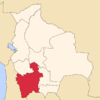 | |
| Municipalities (and seats) |
| |
This article is issued from Wikipedia - version of the 5/3/2016. The text is available under the Creative Commons Attribution/Share Alike but additional terms may apply for the media files.