Shire of Coorow
This article is about a local government area. For the town, see Coorow, Western Australia.
| Shire of Coorow Western Australia | |||||||||||||
|---|---|---|---|---|---|---|---|---|---|---|---|---|---|
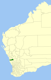 Location in Western Australia | |||||||||||||
| Population | 1,085 (2013 est)[1] | ||||||||||||
| • Density | 0.25871/km2 (0.6701/sq mi) | ||||||||||||
| Established | 1962 | ||||||||||||
| Area | 4,193.9 km2 (1,619.3 sq mi) | ||||||||||||
| President | Moira Girando | ||||||||||||
| Council seat | Coorow | ||||||||||||
| Region | Mid West | ||||||||||||
| State electorate(s) | Moore | ||||||||||||
| Federal Division(s) | Durack | ||||||||||||
 | |||||||||||||
| Website | Shire of Coorow | ||||||||||||
| |||||||||||||
The Shire of Coorow is a local government area located in the Mid West region of Western Australia, about 290 kilometres (180 mi) north of Perth, the state capital, and about 130 kilometres (81 mi) south of the city of Geraldton. The Shire covers an area of 4,194 square kilometres (1,619 sq mi) and its seat of government is the town of Coorow, with the largest settlement being Leeman.
History
Historically, the area was part of the Carnamah Road District. On 19 April 1962, the Shire of Coorow was created.[2]
Wards
The Shire has eight councillors, elected at large. Wards were abolished in 2003.
Towns
- Coorow
- Green Head
- Gunyidi
- Leeman
- Marchagee
- Waddy Forest
- Warradarge
Population
| Year | Population |
|---|---|
| 1966 | 808 |
| 1971 | 912 |
| 1976 | 1,136 |
| 1981 | 1,253 |
| 1986 | 1,393 |
| 1991 | 1,526 |
| 1996 | 1,389 |
| 2001 | 1,338 |
| 2006 | 1,199 |
| 2011 | 1,067 |
References
- ↑ "3218.0 Regional Population Growth, Australia. Table 5. Estimated Resident Population, Local Government Areas, Western Australia". 3 April 2014. Retrieved 11 September 2014.
- ↑ WA Electoral Commission, Municipality Boundary Amendments Register (release 3.0), 31 July 2007.
External links
Coordinates: 29°52′44″S 116°01′23″E / 29.879°S 116.023°E
This article is issued from Wikipedia - version of the 11/27/2016. The text is available under the Creative Commons Attribution/Share Alike but additional terms may apply for the media files.