Senduary
| SENDUARY | |
|---|---|
| Gram Panchayat | |
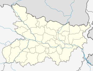 SENDUARY  SENDUARY Location in bihar , India | |
| Coordinates: 25°44′20.2″N 85°16′43.4″E / 25.738944°N 85.278722°ECoordinates: 25°44′20.2″N 85°16′43.4″E / 25.738944°N 85.278722°E | |
| Country |
|
| State | Bihar |
| District | vaishali |
| Assembly Constituency | hajipur assembly constituency (AC.123)[1] |
| Languages | |
| • Official | Hindi |
| Time zone | IST (UTC+5:30) |
senduary is a Gram panchayat in hajipur, vaishali district, bihar.
Geography
This panchayat is located at 25°44′20.2″N 85°16′43.4″E / 25.738944°N 85.278722°E
panchayat office
panchayat bhawan Berai (पंचायत भवन Berai )[2]
Nearest City/Town
Nearest major road highway or river
SH 49 ( state highway 49)[4]
compass
 |
afajalpur dhobghatti | | ||
| |
||||
| ||||
| | ||||
| panapur langa | chakunda urf milki |
Villages in panchayat
There are villages in this panchayat[6]
| s.n | villages | |
|---|---|---|
| 1 | Chak Rasul | |
| 2 | Berai Urf Panapur | |
| 3 | Senduari Gobind | |
| 4 | Paranpur Senduari Chak Hamida | |
| 5 | Panapur Loawan urf Biropur | |
| 6 | Nainha | |
| 7 | Arazi Nainha | |
See also
References
- ↑ The Chief Electoral Officer of Bihar official,hajipur pdf
- ↑ Panchayati Raj Department,Government of Bihar page number 7
- ↑ village profile census government official website State - Bihar, District- vaishali, Sub District - Hajipur
- ↑ Map - vaishali district official government website file type: image/jpeg, size:13.9 MB
- ↑ The Chief Electoral Officer of Bihar official,hajipur pdf
- ↑ Reports of National Panchayat Directory Ministry of Panchayati Raj Government of India List of Census Villages mapped for SENDUARY Gram Panchayat,HAJIPUR,VAISHALI,BIHAR Report printed on 26/09/2014 National Panchayat Portal,Panchayat Informatics Division
This article is issued from Wikipedia - version of the 8/26/2016. The text is available under the Creative Commons Attribution/Share Alike but additional terms may apply for the media files.