Schwarzautal
| Schwarzautal | ||
|---|---|---|
| ||
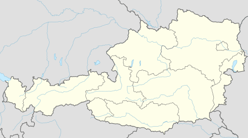 Schwarzautal Location within Austria | ||
| Coordinates: 46°49′48″N 15°40′48″E / 46.83000°N 15.68000°ECoordinates: 46°49′48″N 15°40′48″E / 46.83000°N 15.68000°E | ||
| Country | Austria | |
| State | Styria | |
| District | Leibnitz | |
| Government | ||
| • Mayor | Alois Trummer (ÖVP) | |
| Area | ||
| • Total | 40.22 km2 (15.53 sq mi) | |
| Elevation | 304 m (997 ft) | |
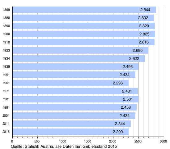
| Population (1 January 2016)[1] | ||
| • Total | 2,299 | |
| • Density | 57/km2 (150/sq mi) | |
| Time zone | CET (UTC+1) | |
| • Summer (DST) | CEST (UTC+2) | |
| Postal codes | 8421, 8413, 8422 | |
| Area code | 03184 | |
| Website | www.schwarzautal.gv.at | |
Schwarzautal is a market town since 2015 with 2,299 residents (as of 2016-01-01) in the Leibnitz District of Styria, Austria.
The municipality was founded as part of the Styria municipal structural reform,[2] at the end of 2014, by merging the five former towns: Schwarzau im Schwarzautal, Wolfsberg im Schwarzautal, Breitenfeld am Tannenriegel, Hainsdorf im Schwarzautal and Mitterlabill.[3]
The towns Mitterlabill and Schwarzau im Schwarzautal had been in the political district Südoststeiermark, while the other towns were already in the district of Leibnitz. The boundaries of the districts and the judicial districts have been changed so that the new community is now fully in the district and jurisdiction Leibnitz.[4]
The former municipalities Mitterlabill and Schwarzau im Schwarzautal were until the end of 2012 in the Feldbach District and had the Kfz car symbol "FB". From mid-2013 until the end of 2014, the "SO" label was assigned, but since 2015 it has been "LB".
Geography
Municipality arrangement
The municipality territory includes nine Katastralgemeinden and 12 towns (populations and areas as of January 2015[5]):
| Katastralgemeinden | Town |
|---|---|
|
|
Neighboring municipalities
The municipality is enclosed by ten neighboring communities, four of which lie in the Südoststeiermark District (SO).

Demographics
Politics
Mayor
Alois Trummer (ÖVP) was elected in the inaugural meeting of the Municipal Council in April 2015 as mayor of the new municipality.[6]
The municipal council further includes the Deputy Mayor Martin Kohl (ÖVP) and the municipality treasurer Rupert Wahrlich (Schwarzautal Active - List Rupert Wahrlich).[7]
Municipal council
The municipal council consists of 15 members. According to the results of the municipal elections in 2015, the mandate allocation is as follows:
The prior elections had the following results:
| Party | 2015 | 2010 | ||||||||||||||||
|---|---|---|---|---|---|---|---|---|---|---|---|---|---|---|---|---|---|---|
| Schwarzautal | Schwarzau im Schwarz. | Breitenfeld | Hainsdorf | Mitterlabill | Wolfsberg im Schwarz. | |||||||||||||
| Votes | % | Mandate | V. | % | M. | V. | % | M. | V. | % | M. | V. | % | M. | V. | % | M. | |
| ÖVP | 795 | 49 | 8 | 380 | 100 | 9 | 137 | 100 | 9 | 191 | 100 | 9 | 287 | 100 | 9 | 252 | 41 | 4 |
| SPÖ | 66 | 4 | 0 | not running | not running | not running | not running | 83 | 13 | 1 | ||||||||
| FPÖ | 145 | 9 | 1 | not running | not running | not running | not running | not running | ||||||||||
| Schwarzautal Aktiv Liste Rupert Wahrlich |
631 | 39 | 6 | not running | not running | not running | not running | 286 | 46 | 4 | ||||||||
| Counts | 1,974 | 536 | 174 | 247 | 367 | 678 | ||||||||||||
| Percentage | 84% | 76% | 81% | 81% | 82% | 93% | ||||||||||||
- All percents are based on the total count.
Coat of arms
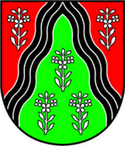
- Wappen der Vorgängergemeinden
 Breitenfeld am Tannenriegel
 Hainsdorf im Schwarzautal
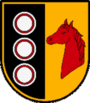 Schwarzau im Schwarzautal
 Wolfsberg im Schwarzautal
Four of the five predecessor towns had a town crest. Because of the merger, they lost their official validity on January 1, 2015. The authorization of the municipal coat of arms, for the fusion community, was carried out with effect from 15 July 2016.
Blazon (crest description):
- "A black, silver-flooded hive, cut in from the upper edge of the shield, in red on each side a three-leafed, seven-beaded silver meadowspowder, and in green center are three (1:2) similar plants".[8]
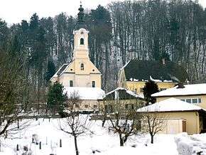
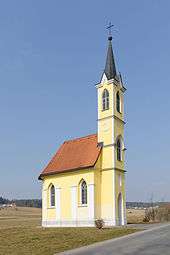
Culture and sights
References
- ↑ Statistik Austria - Bevölkerung zu Jahresbeginn 2002-2016 nach Gemeinden (Gebietsstand 1.1.2016) for Schwarzautal.
- ↑ Steiermärkische Gemeindestrukturreform.
- ↑ Kundmachung der Steiermärkischen Landesregierung vom 3. Oktober 2013 über die Vereinigung der Marktgemeinde Wolfsberg im Schwarzautal und der Gemeinden Breitenfeld am Tannenriegel, Hainsdorf im Schwarzautal, alle politischer Bezirk Leibnitz, und der Gemeinden Mitterlabill und Schwarzau im Schwarzautal, beide politischer Bezirk Südoststeiermark. Landesgesetzblatt für die Steiermark vom 26. Juni 2014. Nr. 75, Jahrgang 2014. Template:ZDB-ID. p. 1.
- ↑ Verordnung der Steiermärkischen Landesregierung vom 10. Juli 2014, mit der die Steiermärkische Bezirkshauptmannschaftenverordnung geändert wird. Landesgesetzblatt für die Steiermark. 10 September 2014. Nr. 99 Jahrgang 2014. Template:ZDB-ID.
- ↑ Einwohner nach Ortschaften (Excel-Datei, 766 KB); accessed on 29 July 2015
- ↑ Gemeinde Schwarzautal: Bürgermeister, accessed on 15 June 2015
- ↑ Gemeinde Schwarzautal: Gemeindevorstand, accessed on 15 June 2015
- ↑ 94. Verlautbarung der Steiermärkischen Landesregierung vom 30. Juni 2016 über die Verleihung des Rechtes zur Führung eines Gemeindewappens an die Marktgemeinde Schwarzautal (politischer Bezirk Leibnitz), accessed on 28 October 2016.
External links
| Wikimedia Commons has media related to Schwarzautal. |
- "Municipal data for Schwarzautal". Statistik Austria.
- Gemeinde Schwarzautal: Official Internet site